Mayapan – Yucatan – Mexico

Mayapan

Mayapan

More on the Maya

Mayapan – Yucatan

Location

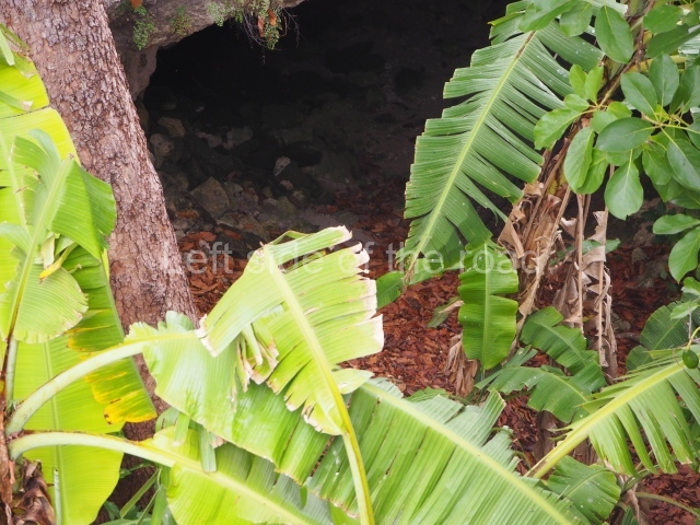
Mayapan is situated 43 km south-east of Merida and 2 km south of the village Telchaquillo. The karst nature of the soil in the Mayapan region has given rise to rocky outcrops and natural depressions, cenotes (wells), caves and holes. The climate is of the hot sub humid variety with the rainfall occurring in the summer months and an average annual temperature of 22° C. The flora consists of deciduous trees and secondary low scrubland.

Pre-Hispanic history

The archaeological evidence suggests that Mayapan was inhabited from before the Common Era until the decline of the city around AD 1450. The data obtained is very general, indicating that people lived in or around the site from the Preclassic and Early Classic periods (300 BC-AD 600). Several stones used in the construction of new temples and residences have survived from the early periods. Mayapan experienced its heyday in the Postclassic period (AD 1050-1450), when it was the seat of a coalition government and the last great centralised capital that ruled over the provinces in the north-west and centre-north of the Yucatan Peninsula.

The first chronicler who mentioned Mayapan was Gaspar Antonio Chi. His father, the priest Napuc Chi, a dignitary of the Xiu, was murdered by Nachi Cocom in 1536; his mother was lx Kupil, of the Mani royal family. Gaspar Antonio was an informant of Brother Diego de Landa and wrote his own chronicle in 1582, where he mentions the importance of the Xiu family and the fact that the city fell in 1420. Around 1560, Brother Diego de Landa mentions that Mayapan was founded by Kukulcan (Quetzalcoatl) in the year Katun 13 Ahau (AD 1263-1283) – when Chichen Itza fell and was abandoned – who ruled for some time and then left for the centre of Mexico. The Chilam Balam notes the existence of a coalition government between Uxmal, Chichen Itza and Mayapan, nowadays known as the Triple Alliance. The archaeological excavations have not corroborated this entirely due to the chronological differences between the three sites: Chichen Itza and Uxmal both experienced their heyday prior to Mayapan. Around 1380, the main rulers decided to form a coalition government, which marked the beginning of a regime led by the Cocom family – as the richest and oldest lineage – until its defeat. The Xiu then arrived from the south and occupied the second position within the Mayapan government due to their diplomatic conduct and administrative expertise. The chronicles refer to the multepal or coalition government led by the Cocom, Xiu and Canul lineages, which occupied Mayapan the longest. Towards the middle of the 15th century, in the Katun 8 Ahau (AD 1441-1461), Mayapan was destroyed, burned and abandoned. The chronicles state that there was a battle to seize control of the walled precinct and dissolve the coalition government.

Site description

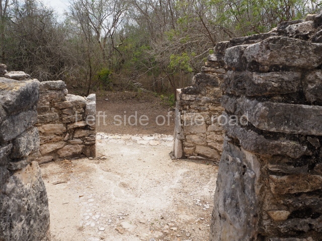
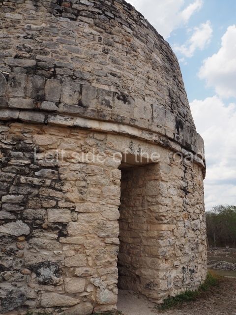
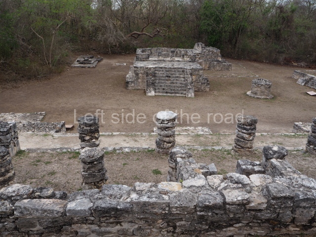
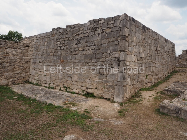
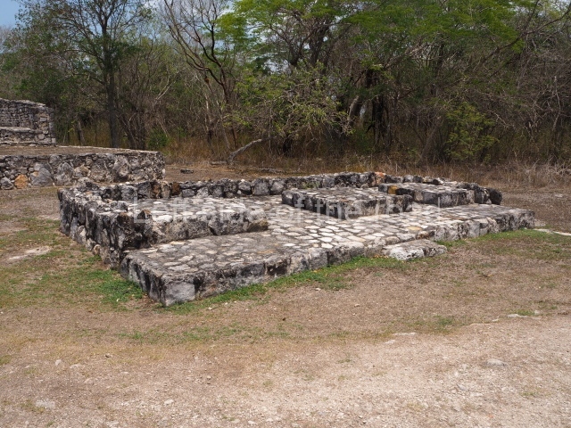
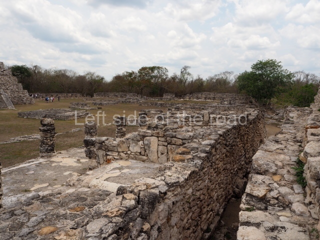
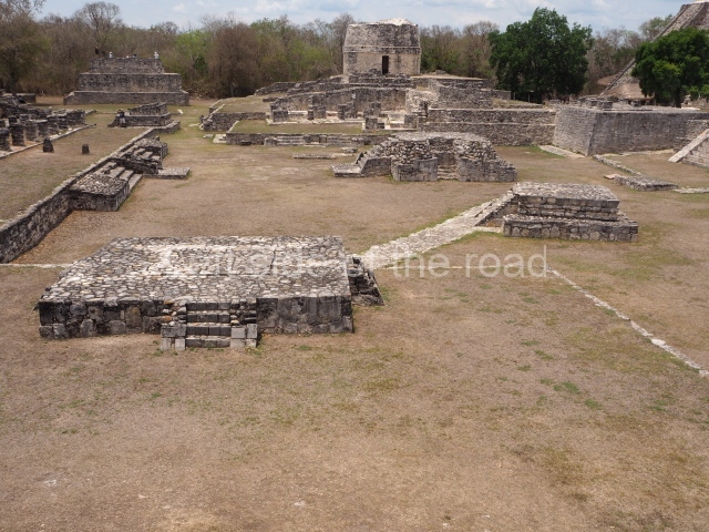
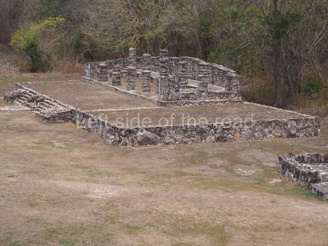
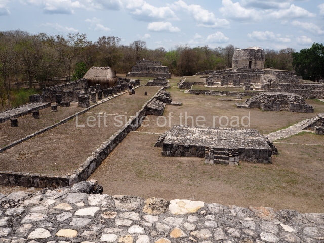
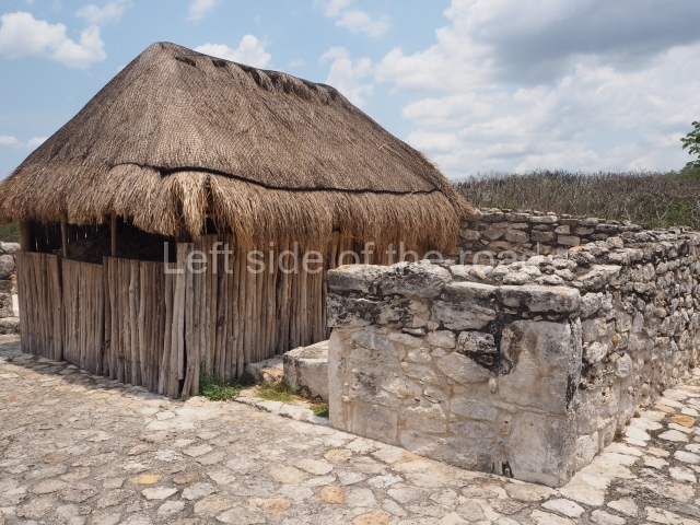
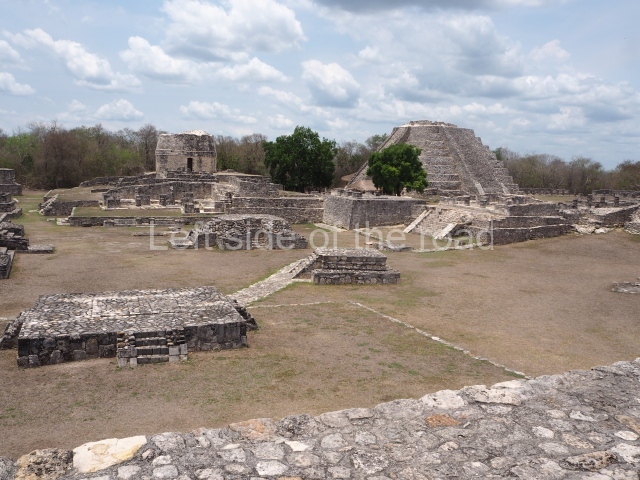
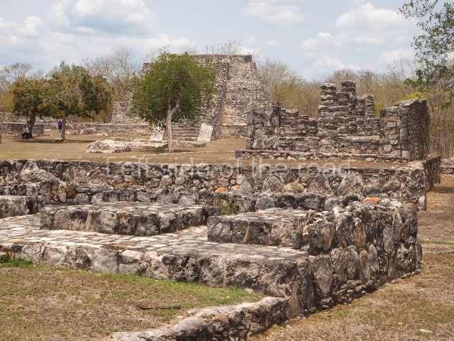
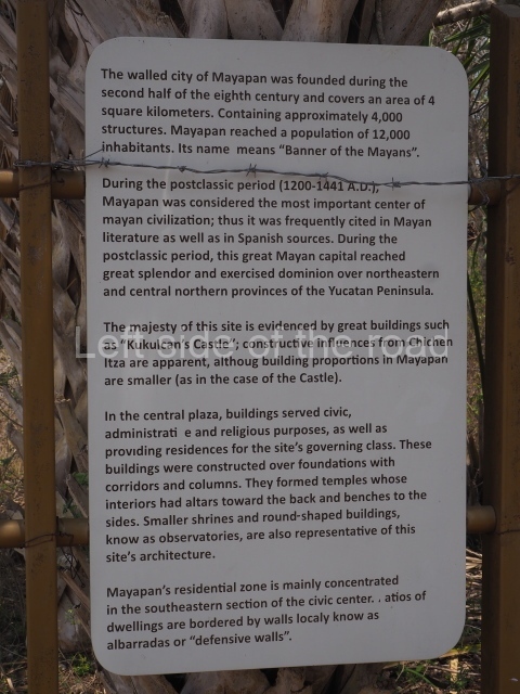
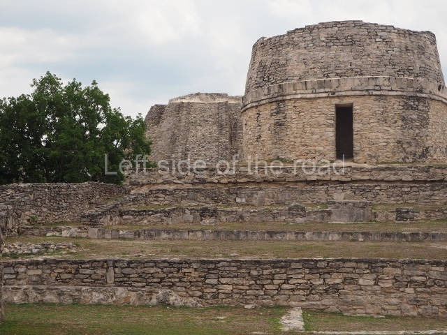
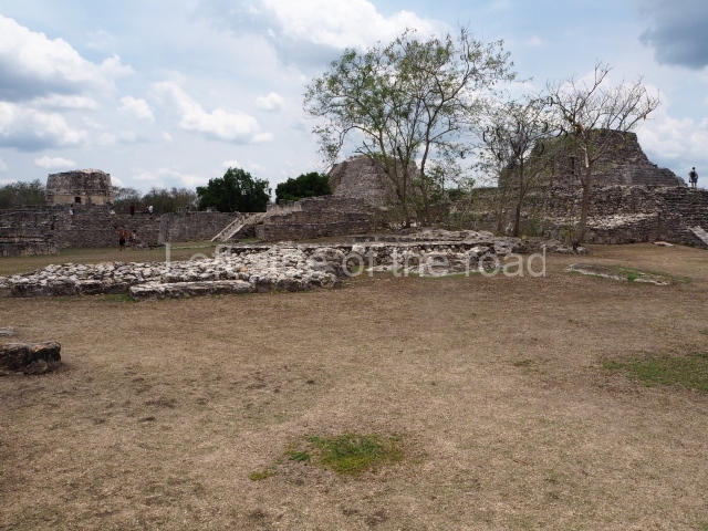
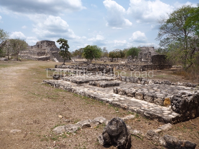
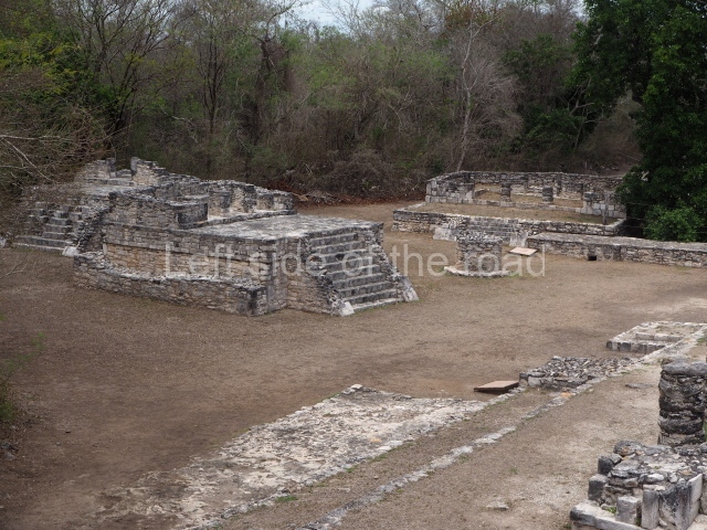
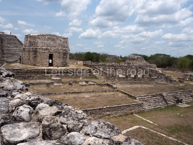
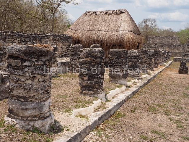
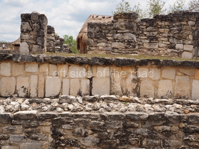
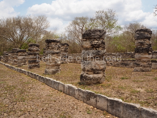
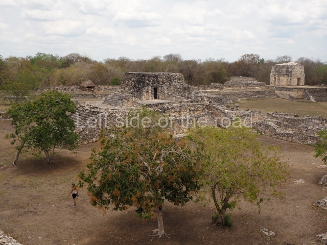
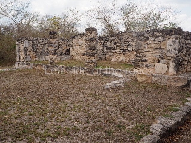
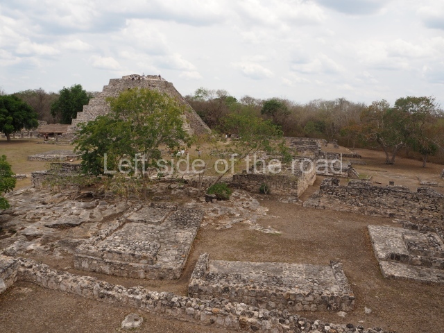
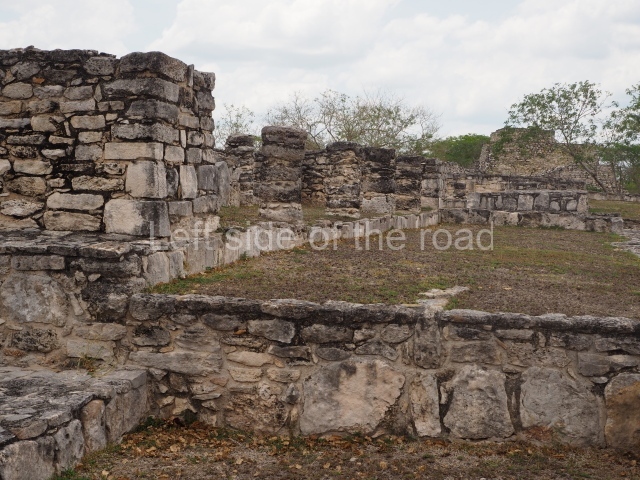
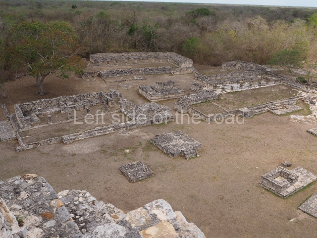
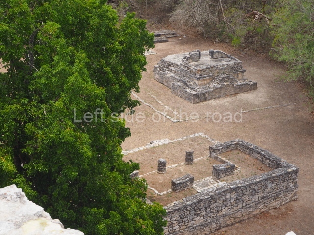
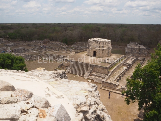
The city of Mayapan is surrounded by an elliptical dry wall which has a circumference of over 9 km and encompasses an area of 4.2 sq km; situated inside it are around 4,000 structures and it is estimated to have had a population of 12,000. The core area comprises the civic, administrative and religious buildings, as well as the residences of the ruling class; these are spacious hypostyle rooms, temples and oratories, constructed on platforms, with wide entrances divided by columns, an altar or shrine inside, abutted to the rear wall, and benches along the sides. Circular buildings known as ‘observatories’ are also characteristic features at Mayapan. Situated inside the walls is the residential area where the population lived, principally in the south-east section. This was the place where the ‘houses for the lords’ were built, ‘between whom they divided up the land, giving villages to each according to the antiquity of their lineage and nature of their person’. This section contains most of the housing and the dry walls that delimit the plots. There are also residential constructions beyond the perimeter wall where the common people lived.

Castle of Kukulcan

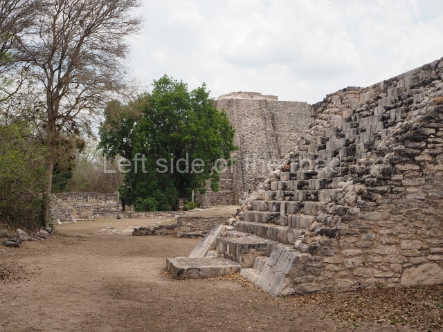
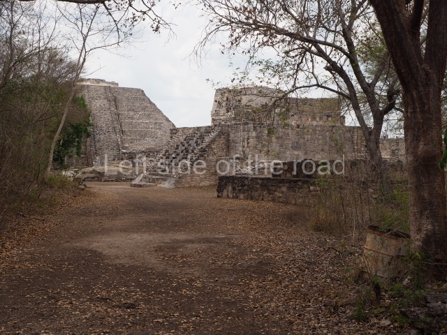
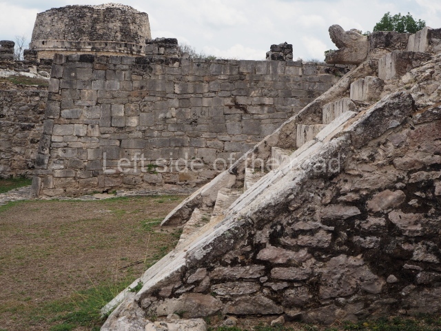
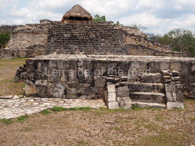
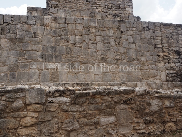
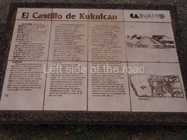
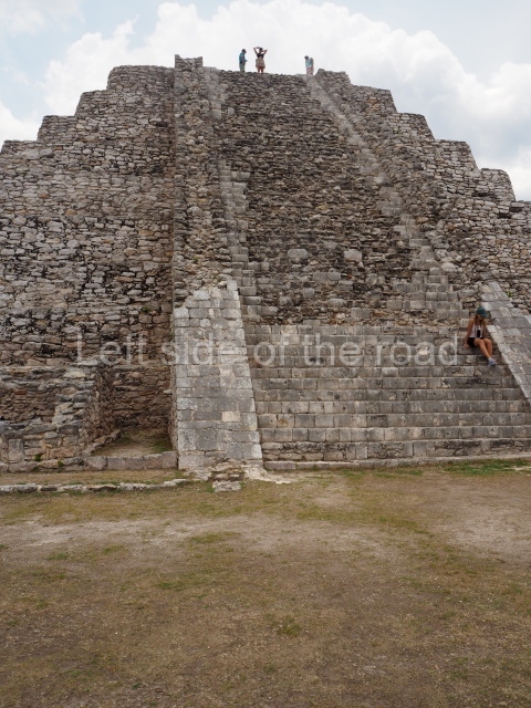
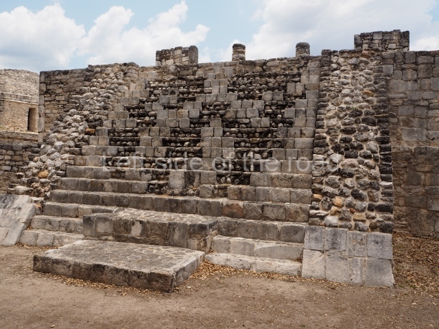
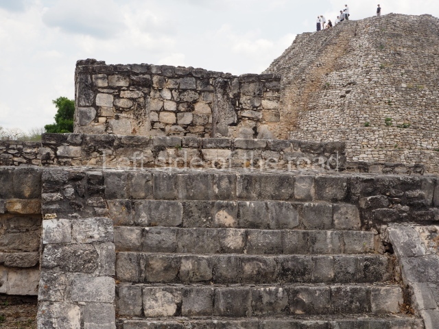
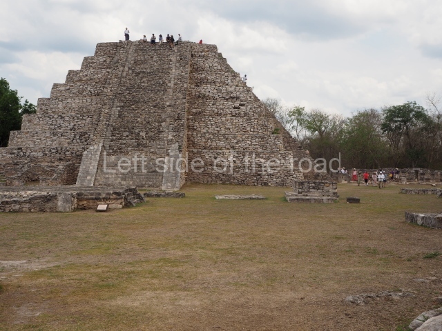
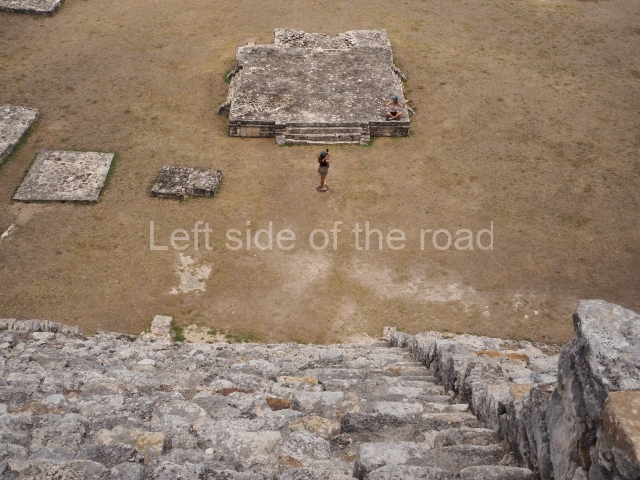
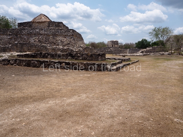
This is situated on the south side of the Central Plaza and is the highest building at Mayapan. It adopts the form of a nine-tier echeloned platform with rounded corners, measuring 30×30 m and standing 18 m high. Each side has a stairway with balustrades. Atop it is a temple with a north-facing facade, the entrance of which consists of a two-column portico once decorated with serpents. There is a sub-structure at the south-east corner of the pyramid, with representations of decapitated warriors in moulded stucco. The discovery of fragments of human skulls inside the niches of the sub-structure confirm that it was used for placing stucco-covered heads, a practice associated with death worship.

Crematorium

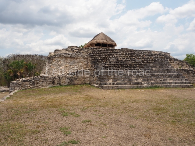
The second-highest pyramid at Mayapan, this is situated on the west side of the North Plaza and is surrounded by a wall on three sides. The structure shows two construction phases comprising four sloping tiers with rounded corners, a temple at the top and a stairway with balustrades on the east side. The temple at the top has a triple entrance separated by two columns and there is a shrine inside. A tomb 7 m deep containing burials was found at the top of the platform. The building is 20 m long, 17 m wide and 8 m high.

Round temple

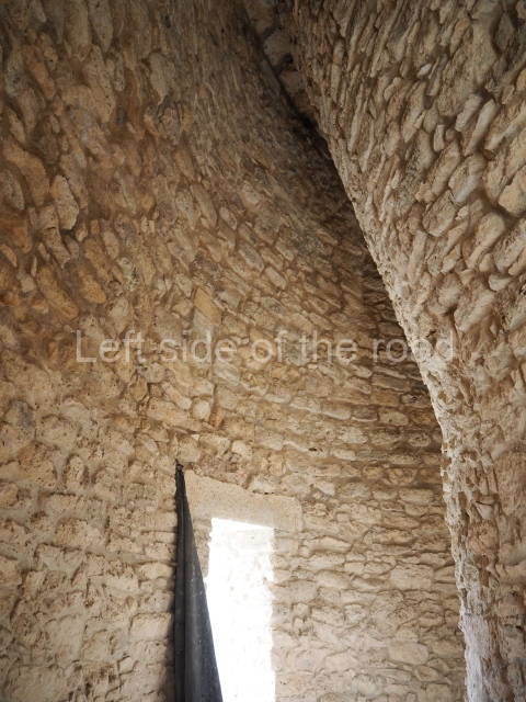
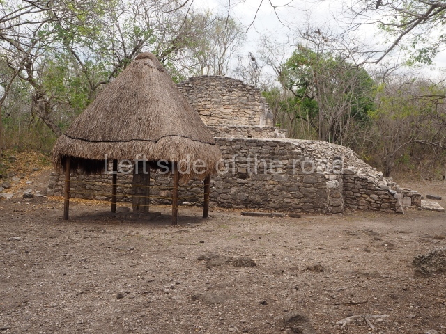
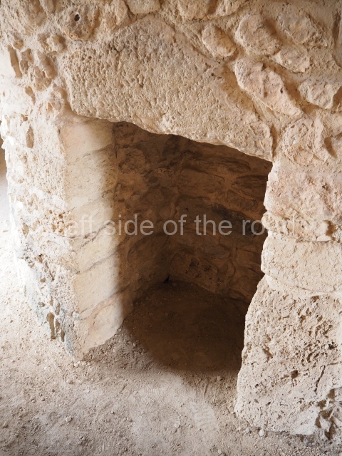
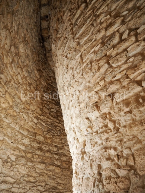
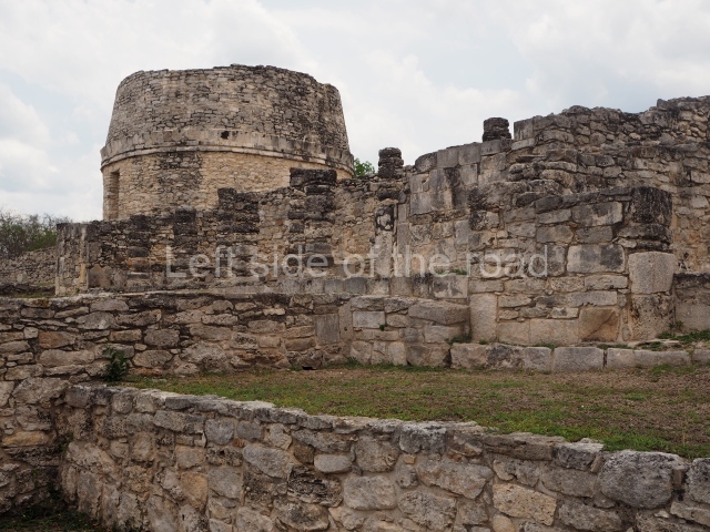
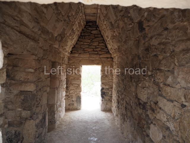
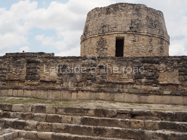
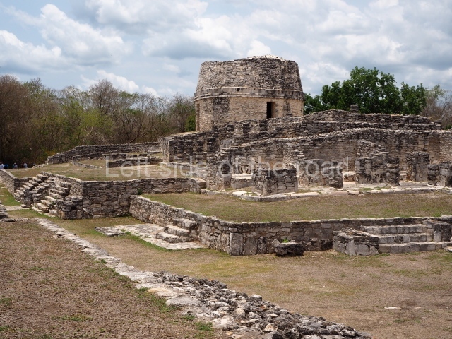
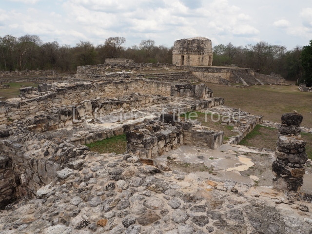
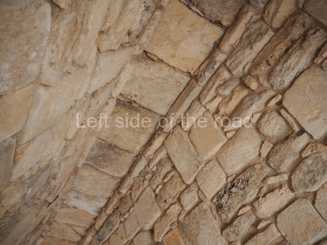
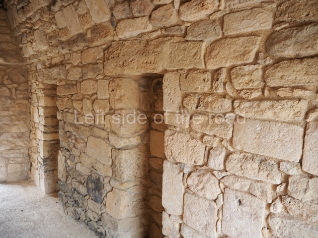
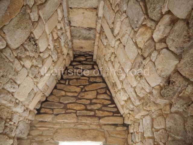
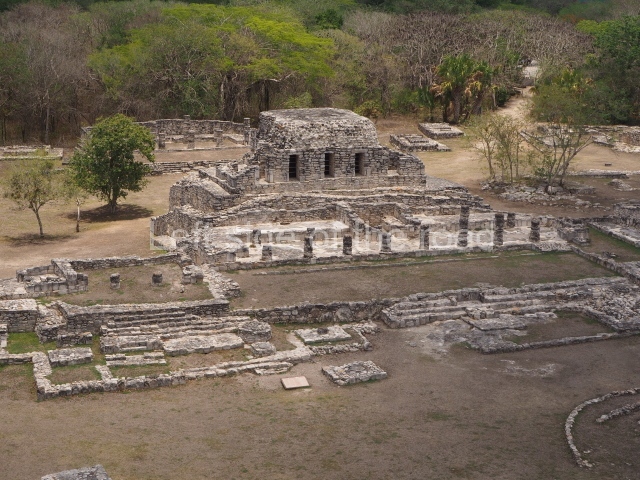
This is situated on the east side of the Central Plaza. It is a rectangular platform with moulding around the top and a balustraded stairway. It is 20 m long, 18 m wide and 3.5 m high. At the top is a circular, vaulted temple 10.20 m in diameter and 7.50 m in height, with four entrances and thick walls 1.15 m wide. The central part of the temple consists of a cylindrical volume 4.50 m in diameter with four niches in the lower section, two of which show traces of mural paint. This volume and the walls form the interior space, measuring 2.75 m in width and 6 m in height. There are also two small constructions – a small altar on a dais and a shrine – on the north side of the stairway.

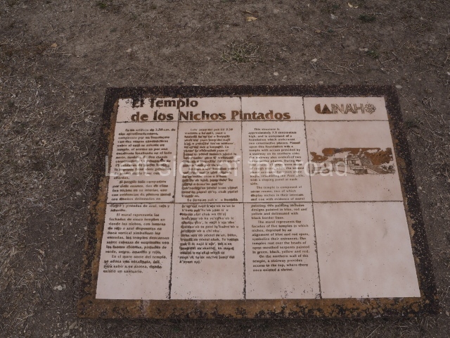
Temple of the painted niches

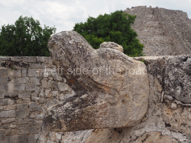
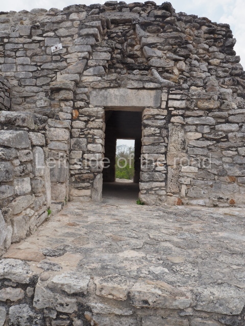
This is situated on the south side of the North Plaza and stands 7.50 m high. There is a stairway on the north side of the Plano de la Plaza Central de Mayapan: platform, built in two stages. The temple at the top is composed of seven rooms; two have niches inside and one of them has traces of mural paint depicting the facades of five temples, where the niches symbolise the entrances; the designs are outlined in black and painted in blue, red and yellow. The temples rest on serpent heads with open mouths, painted green, black, yellow and red.

Temple of the Fisherman

This occupies the north side of the North-East Plaza. The platform has sloping walls and a cornice on two of its four construction phases; it is 21 m long, 17.40 wide and 5 m high. The stairway leading to the temple is on the south side; the latter has a single bay with two pilasters at the front and a dividing wall. In the east room are two benches and an altar in the middle. The west bench contains traces of a scene depicting a human figure catching a lizard and fish.

Hall of the masks

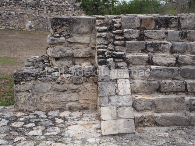
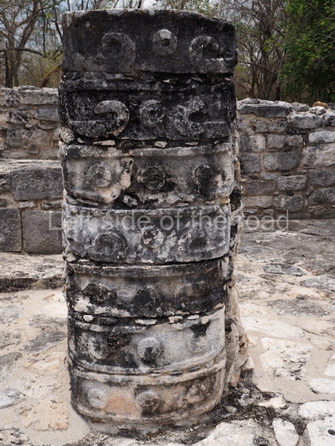
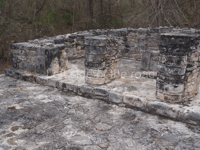
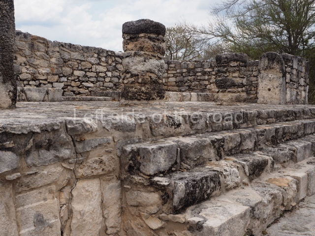
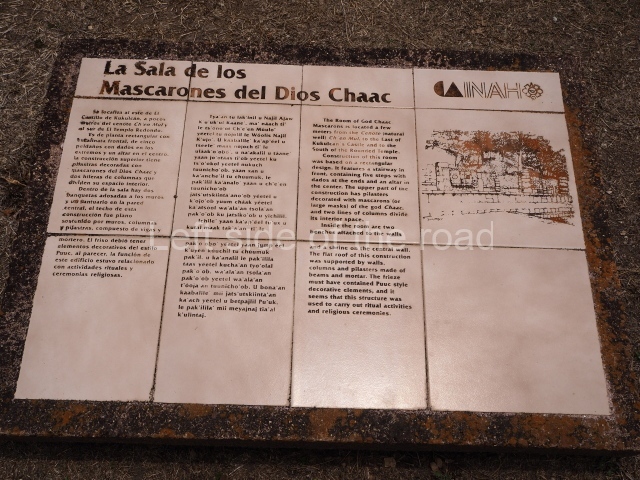
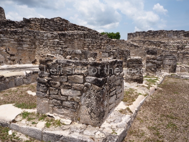
Situated south of the Round Temple, the platform has a five-step stairway with finial blocks and an altar in the middle. The hall contains pilasters decorated with masks of the god Chaac, two rows of columns, two benches abutted to the walls and a shrine in the middle.

Fresco hall

This adjoins the lower sections of the east side of the Castillo. The building has columns on three of its sides and pilasters at the north-east and south-east corners; in the middle is an L-shaped wall with a bench on the north side and an altar in the middle. There are traces of paint on the central wall. The scene consists of red and yellow marks which frame richly attired figures in profile, painted red and yellow on a blue background. The figures hold a circular banner with representations of sun disks.

Hall of the kings

In this building the columns rise from an artificial platform at the south-west corner of the Central Plaza. There is a central wall with an intermedial entrance, a bench with moulding and pilasters at the corners. The excavations uncovered the stucco faces of the important personages that decorated the columns.

Temple of the Chen Mul cenote

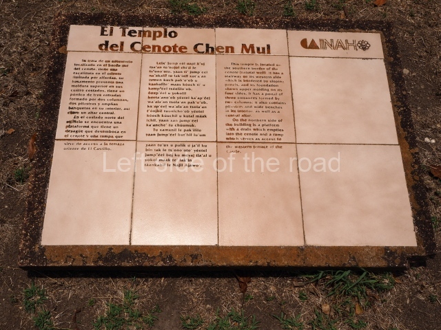
Situated on the south bank of the cenote, this oratory displays a balustraded stairway and moulding along the top of the platform. The temple is fronted by a portico with three entrances formed by two columns, two pilasters, benches and an altar inside. On the north side of the building there is a sloping platform for rainwater to drain into the Chen Mul Cenote and a ramp leading to the Castillo terrace.

Temple of the warriors

Situated on the west side of the North-East Plaza, this is a two-tier platform with a temple at the top with three entrances and a shrine and altar inside. It is accessed via a balustraded stairway which culminates in finial blocks and serpent heads.

Temple of Venus

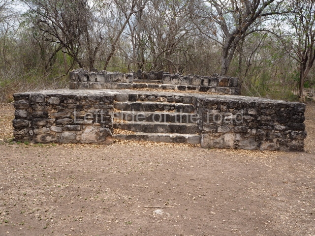
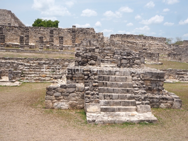
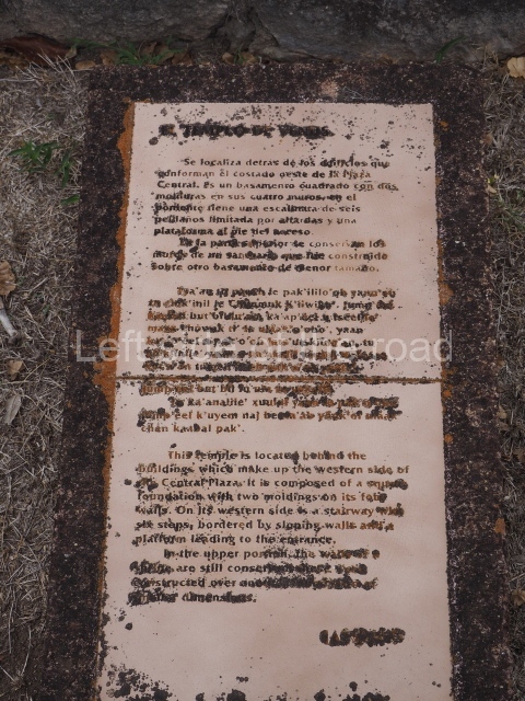
This is situated in the West Plaza of Mayapan. It takes the form of a square platform with two mouldings; there is a balustraded stairway and a shrine at the top.

Ceramics

Mayapan contains a wide variety of types and forms of ceramics. The most interesting are the effigy incense burners, which denote different decorative techniques to personify the gods. The pottery comprises finely made polychrome vessels as well as coarse monochrome pots for domestic use.

Importance and relations

This great Maya capital established in the second half of the 13th century was the most important centre of the Maya civilisation during the Postclassic period (AD 1050-1450), exercising its domain over the provinces in the north-west and centre-north part of the Yucatan Peninsula until just before the Spaniards reached the continent. The magnificence of the city is manifested in the grand and densely concentrated buildings. The architectural characteristics denote the strong influence of Chichen Itza. The main building at Mayapan, known as the Castle of Kukulcan, is a smaller version of the Castillo pyramid at Chichen Itza. Roys suggests that the Mayapan government was in some way associated with the island of Cozumel and Champoton. There is another walled site in the Chetumal region that existed at the same time as Mayapan, called Ichpaatun.

Carlos Peraza Lope

From: ‘The Maya: an architectural and landscape guide’, produced jointly by the Junta de Andulacia and the Universidad Autonoma de Mexico, 2010, pp 412-417.

Mayapan

Mayapan

1. Castle of Kukulcan; 2. Round Temple; 3. Temple of the Painted Niches; 4. Hall of the Masks; 5. Fresco Hall; 6. Hall of the Kings; 7. Temple of the Warriors; 8. Temple of Venus.

Getting there:

Bus station on Calle 50, near corner of Calle 67 in Merida. Buses leave 05.30, 07.30. 09.30. Drops you at slip road to site. M$30.

GPS:

20d 37′ 56″ N

85d 27′ 32″ W

Entrance:

M$70

More on the Maya

The Roman City of Baetulo, Badalona Museum

House - Museu de Badalona. Antonio Guillén

House – Museu de Badalona. Antonio Guillén

More on Catalunya/Catalonia

The Roman City of Baetulo, Badalona Museum

I’d think I’d be fairly safe in saying that the overwhelming majority of people who visit Barcelona aren’t there for what remains from the Roman period – many not being aware that the Romans had actually been there in the first place – most coming to view the Modernist architecture of the likes of Antonio Gaudí and Lluís Domenech i Montaner. That’s a shame as the city has remnants from 2,000 years ago, although admittedly some of them need to be searched out. Even fewer people would be aware that just a few kilometres down the Metro line to the north-east of Barcino (the Roman name for Barcelona) is the Roman City of Baetulo at Badalona Museum, one of the most important Roman archaeological sites in Catalonia.

Baetulo dates back to the early part of the first century BC (or BCE, as it is sometimes referred) and was one of the first Roman settlements to be established in the Iberian Peninsular. Later there would be a whole line of these along the coastal road that would go as far south as Andalusia, passing by Baleo Claudio (for the salted tuna and garum) just south of Cadiz on the Atlantic coast, up to Italica, at present day Santponce, just across the Cuadalquivir from Seville, the virtual bread basket of the Roman Empire.

The city was walled and originally would have been much closer to the coast. That’s difficult to imagine nowadays as the beaches of Badalona are a long way from the museum. However, everything falls into place when you remember that to the south-west, just under halfway to Barcelona, is the River Besos. Its delta in the past was much more extensive and the years of taking water from further upstream for agriculture and its ‘taming’ close to human settlements has changed the ecology of the littoral.

Excavation of the site were the museum now stands began in 1955 and soon after it was decided to build the museum on top of it to aid in its preservation. I’m not sure if I am a big fan of such preservation. Yes, it does prevent erosion and other damage caused by the weather but it makes for a strange experience when visiting the site. Recent modernisations and improvements to the exhibition space have meant that you see the ruins in very subdued light and creates a sensation quite unlike any other such archaeological site I’ve visited. The city that originally would have been bleached and burnt by the Mediterranean sun now exists in a permanent twilight, with all the concrete and metal surfaces of the modern building being painted black.

Nonetheless, what you get is a very good idea of what a Roman town would have been like, there being set conventions and structures that were common in settlements of the Republic and Empire that were repeated for the 500 years or so before internal conflict and foreign invasion saw the inevitable end of the most powerful empire up to that time. More recent empires can only dream of such a period of dominance – just remember the Nazi dream of a ‘Thousand Year Reich’ and the way that US dominance of the world is being threatened by the upsurge in the Chinese economy.

The area in the museum, which covers about 3,400 m², must have been the earliest to have been built as parts of the Cardo Maximus and Decumanus Maximus are both within the uncovered site. These roads were the two principal thoroughfares around which the rest of the city would be constructed.

The Cardo Maximus took an east-west orientation, often strictly adhering to the points of the compass, but in Baetulo the line of the coast was taken as the point of reference (as well as the compass) so here this main street runs from the coast to the mountains. The Decumanus Maximus was normally constructed along a north-south axis but in Baetulo is parallel to the coast. At the ends of these two main roads you would have found the gates into the walled town. Also it was traditional that the Forum would have been built at their intersection and that would place it, more or less’ in the top left hand corner of the site, just to the left of the exhibition area. When the town was first constructed the Forum would have been very much in the centre of the settlement but as the place grew in importance it expanded massively and reached about 10 hectares in size before its decay in the 6th century AD (CE in modern parlance).

What of the buildings on show. One of the main areas, and one of the most important in any Roman town, is that of the bath house (thermae). These always followed a very regular pattern and anyone who has already visited a Roman town will be aware of the arrangement.

First there’s the atrium, which is the first room on entry where entrance fees were paid and people would meet up with their friends, business acquaintances or fellow plotters if something nefarious was on the cards.

The baths proper began with the apodyterium (the changing room) and connected to that is the frigidarium (a cold plunge pool). Through a doorway next there’s the tepidarium (the warm room, so that customers would be able to adapt to the rising temperatures). This was a place to sit and talk and at Baetulo they have reconstructed a bench to give a better impression of the look of the room – many years in the past the original bench had been taken and all that was left was the depression in the floor. This is also the room with the only mosaic on show (there are more at another nearby site, the House of the Dolphins). Although much of the worked stone would have been looted once the Roman town fell into disuse the mosaics survive as stealing them would be like stealing a jigsaw puzzle where the box lid had been lost.

Mosaics - Museu de Badalona. Antonio Guillén

Mosaics – Museu de Badalona. Antonio Guillén

Next to that is the caldarium (the really hot room), what we would now call a sauna. This was closest to the fire which provided all the heat through under floor channels and vents. You look down on these rooms from the metal walkway that leads you around the site.

Traditionally along the two major roads virtually every building would have a commercial use at street level – any living accommodation here being on the first floor – all ready to get people’s money as they came through the city gates. These premises would be a mix of shops, taverns and brothels – although the information boards are quiet about the latter product of the free market. Here it’s worth mentioning that there’s a lot of information on these panels, by each building or place of interest, in three languages, Catalan, Spanish and English.

One of the good things about visiting these different sites is that either a new piece of information is pointed out to you or you see something that makes you think in a different way. Here looking down at a modest house, more like a one room bedsit, our guide pointed out that there were rarely any cooking facilities in the more modest homes and that all cooked meals would be taken in the local taverns, something which is still seen in certain parts of the world to this day. (I’ve noticed a similar situation in countries as far apart as Peru and Vietnam.) Also there’s one building that still has the remains of wall paintings and another that’s been identified as a workshop.

However, the aspect of the site that’s very obvious is the importance the Romans placed on their drainage and sewerage system (cloacas in both Catalan and Spanish). As what has been uncovered contains parts of the two principal streets it’s possible to see how the system goes from the smaller channels from each building, then into the smaller streets and finally from there to the main drains which go downhill towards the sea. I can’t imagine that anyone would want to swim in the Mediterranean just below Baetulo but the system meant that all the filth was kept away from where people lived, ate, shopped and worked. The remains of a water supply duct constructed in the time of Tiberius, in the 1st century AD, can be visited only a couple of hundred metres away from the museum.

Roman Drains - Museu de Badalona. Antonio Guillén

Roman Drains – Museu de Badalona. Antonio Guillén

It’s one of those questions which will never get a satisfactory answer. Once the Romans lost their power, in all parts of the known world where they had a presence, the marble, the worked stone, anything of removable value was looted but it seems that no one thought to ‘steal’ (or even borrow) the knowledge of underground heating, providing a clean water supply and getting rid of human waste. It wasn’t until the late 19th century that these issues were accepted as needing a solution in order to make it possible to actually live in the major industrial cities that were mushrooming with the advance of the industrial revolution. Up to that time most cities were literally cesspits of filth, stench and disease. We started to get it right in Britain for about a hundred years but now we’re going backwards as privatisation puts profit before anything else. The only benefit from that, together with fracking, is that soon people will be able to get their gas and water through the same pipe. (See the 2010 film Gasland.) To the best of my knowledge the water and drains in Roman times were a public enterprise.

The basement also houses an exhibition space with artefacts found within the area of the old Roman town as well as an audio-visual presentation that, through the use of Computer Graphics Imaging, attempts to give an idea of what the city would have looked in its heyday (together with graffiti on the walls).

Exhibition Space - Museu de Badalona. Antonio Guillén

Exhibition Space – Museu de Badalona. Antonio Guillén

The collection, which is well presented, contains the ‘usual’ articles you find in such museums: amphora – for the storage and transport of, in the main, olive oil and wine; little pottery olive oil lamps for lighting – being so used to instant light at the flick of a switch we forget that in previous times light was at a premium and there must have been millions of these delicate and often beautifully decorated vessels made during the time of the Republic and Empire; sculptured heads on a spike – the bodies of the statues were made on a production line process and the individual heads were then added to order, this meant that when an Emperor was deposed they only had to change the head; pieces of glass and ceramics used in everyday life and which were discarded in huge quantities – so much of archaeological knowledge comes from people sorting through previous generation’s rubbish; funereal stelae, including three from the Iberian period; capitals and pieces of columns that had either been missed by looters or thought of no use; toys for children and pieces of wood, bone or stone that had been shaped and carved for use in games for both children and adults; and, as always, a small collection of erotica used as amulets and sometimes on a much bigger scale.

As is often the case each of these museums/exhibitions will have their unique finds and that’s the case with Badalona. One object is called The Badalona Venus. This is a beautifully carved and extremely anatomically accurate statue of a young woman. It would have stood about 18 inches high but unfortunately all that remains is the torso, the head, arms and the lower legs having suffered the ravages of time. These statues are often given great importance as symbols of love, fertility, desire, wealth and all the rest. It might have been all of those or none but it is still a very attractive statue and perhaps more so due to its small size, something that might have been lost if it was bigger.

Badalona Venus - Museu de Badalona. Antonio Guillén

Badalona Venus – Museu de Badalona. Antonio Guillén

I don’t know why I hadn’t thought of it before but on looking on this Venus I started to wonder why the skill of artistic perspective was lost at the same time as the knowledge of sewer construction – and other technological advances of the time. In Romanesque Art (from about 1,000 to the rise of the Gothic and then the Renaissance 3 or 4 hundred years later) the human figure is represented in a comic, grotesque, primitive, naïve way depending upon the location. Not that it doesn’t have charm, and in Barcelona it’s possible to see one of the best collections of such art in Europe in the Museu Nacional d’Art de Catalunya, but it lacks perspective. That skill only started to re-emerge during the Renaissance but for almost a thousand years it was lost.

And that’s disturbing. If we neither learn from our mistakes or successes then we are well and truly snookered. Knowledge, it seems, is not linear in that we can gradually, perhaps sometimes in leaps and bounds, learn more and more. We have to forget, at times for many, many years before we can return to the road towards a higher understanding.

Before I depress myself too much I’ll return to those artefacts in the Badalona Museu that are relatively unique. And the two I’m going to highlight are both made of metal.

I’ve already mentioned that the Cardo and Decumanus Maximus roads would lead to the city gates and in the excavations in the area two bronze sockets were found which would have held the wooden jambs for those substantial gates.

The other metal object is from the end of the 1st century AD and is known as the Tabula Hospitalis (a contract and binding agreement dating from Greek times establishing the norms of hospitality towards guests and visitors), a bronze plaque which records the agreement between the population of the town and the patrician Quint Licini Silvà Granià (part of the grounds of what are considered to have been attached to his house are another area that had been excavated and which can be visited).

So in a relatively small space a lot to see.

A short video to give you a taste of the site can be seen by clicking here

After a tour that lasted about an hour and a half it was our guide, the Directora of the Archive, who suggested we could do a lot worse than try Can Joan for a €10 lunchtime menu (that’s, of course, if you visit in the morning).

Thanks to Montse and Esther of the Badalona Museum for permission to use the photos of Antonio Guillén.

Location:

Museu de Badalona

Plaça Assemblea de Catalunya, 1

08911 Badalona

Tel: +34 933 841 750

Opening Times:

Tuesday – Saturday from 10.00 – 14.00, 17.00 – 20.00

Sunday and Holidays from 10.00 – 14.00

Closed: Mondays, 1st and 6th January; 1st May; 24th June; 15th August; 11th, 25th and 26th September

Cost:

€6.48 – which includes the House of the Dolphins and Quint Licini Garden

Pensioners: €2.70
Website: Museu de Badalona

How to get there:

Go the very end of L2 (the purple one) on the Metro at Badalona Pompeu Fabra. From the main exit go up hill to the next set of traffic lights and cross Avinguda de Martí Pujol and then go along Via Augusta for a couple of hundred metres. The Museum is on the corner of Via Agusta and Carrer de les Termes Romanes.

Instead of rushing out of the Metro, which is the norm in all parts of the world, stay a while and take a look at the pictures in the upper vestibule of the recently modernised station. These are images of the Devils (and the year of their construction) which have been burnt on the night of the 10th May as part of the the May Festival. This act records the attempt of The Devil to seduce who was to become the patron saint of Badalona, Sant Anastasi.

More on Catalunya/Catalonia