Zaculeu – Guatemala
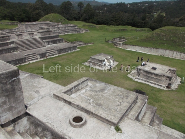
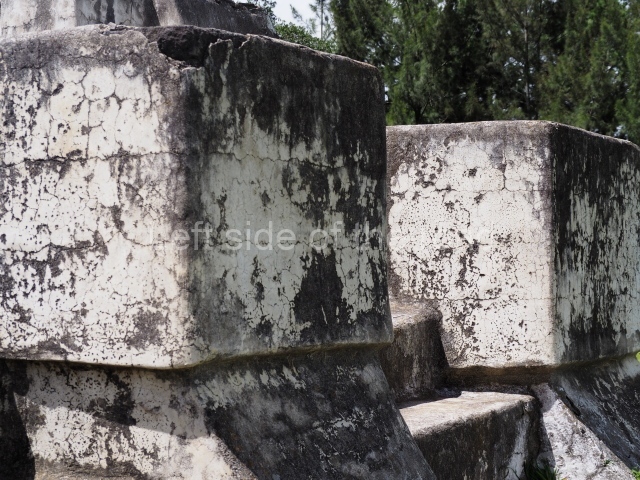
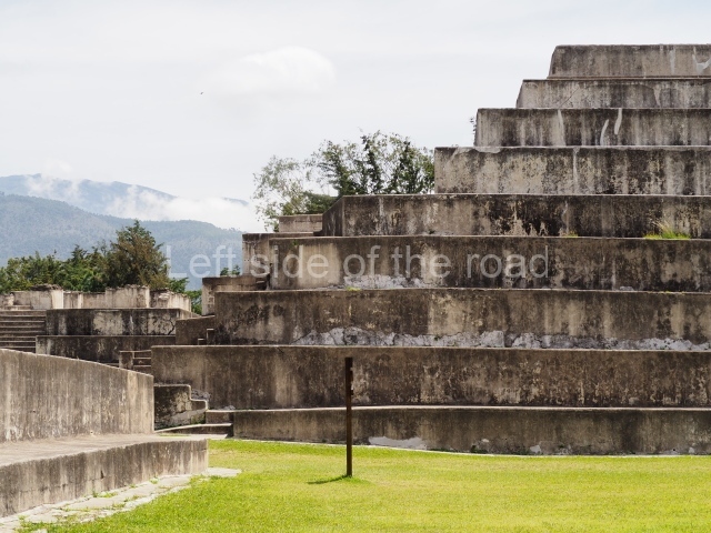
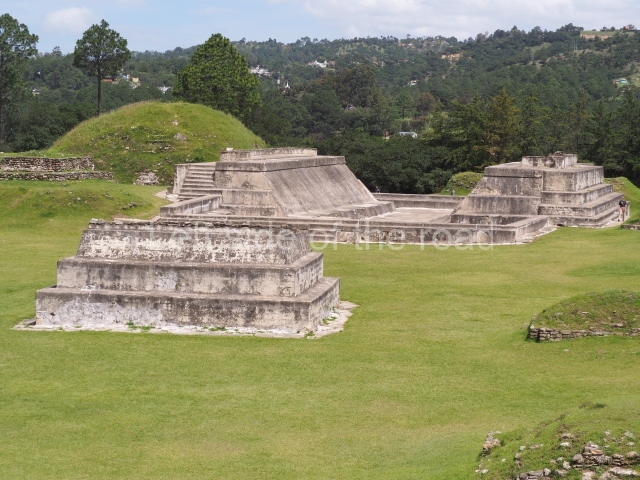
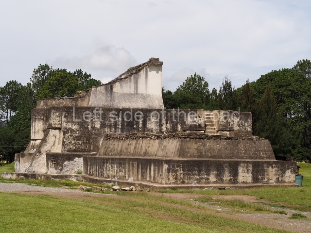
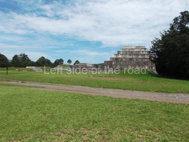
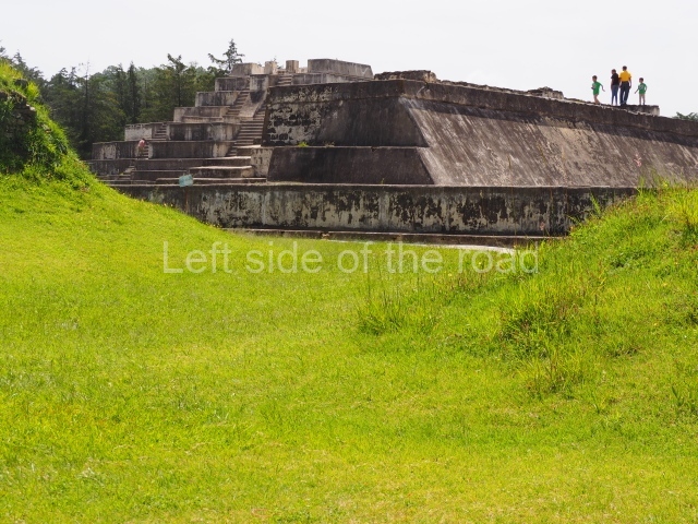
Just before you enter the gates to Zaculeu, on the outskirts of the Guatemalan town of Huehuetenango, you think you are about enter a Mayan archaeological site once inside you realise you have entered a crime scene.
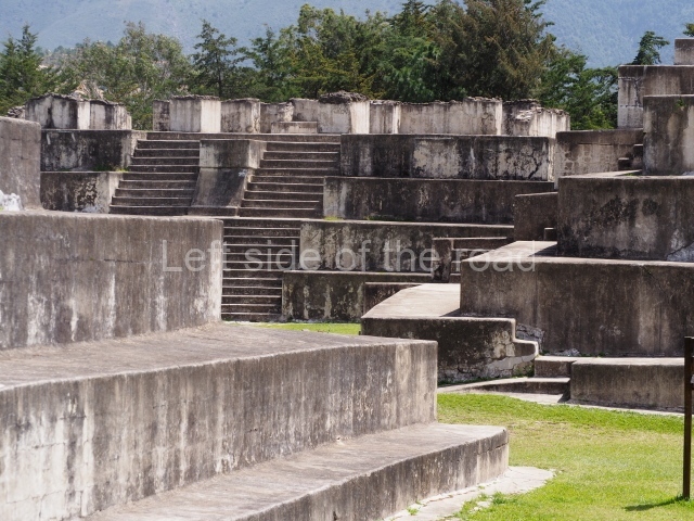
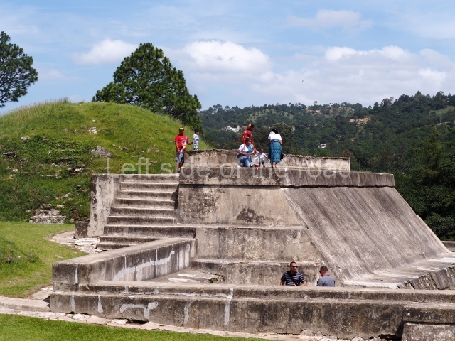
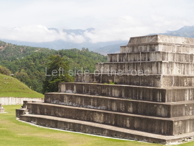
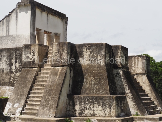
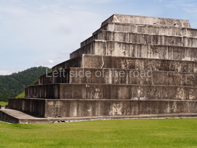
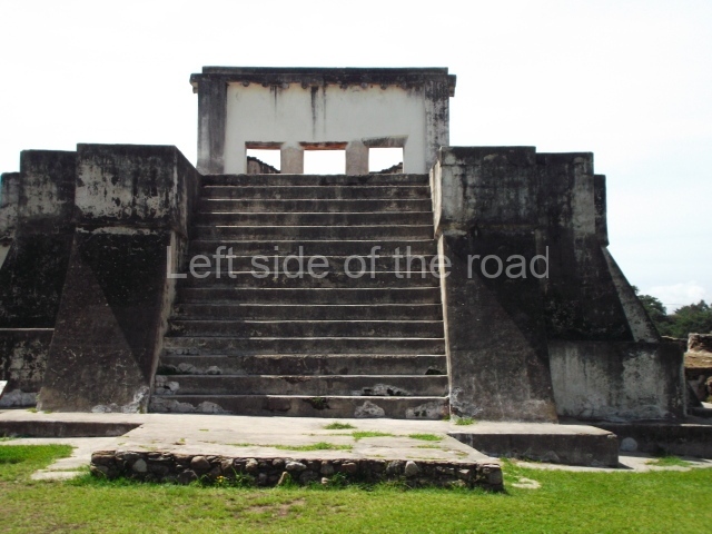
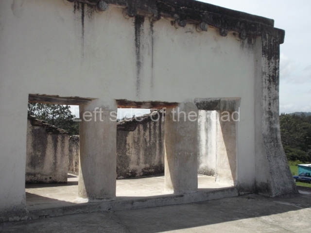
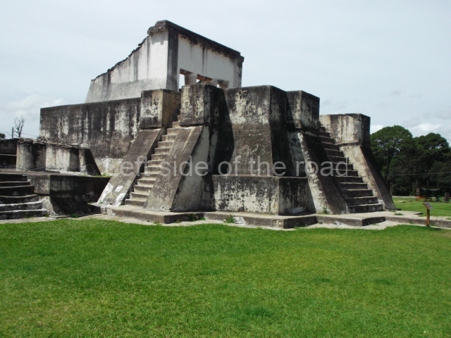
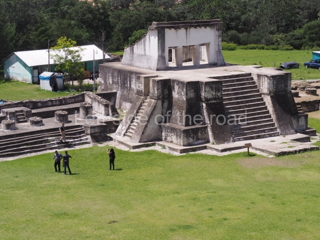
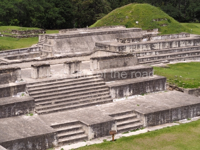
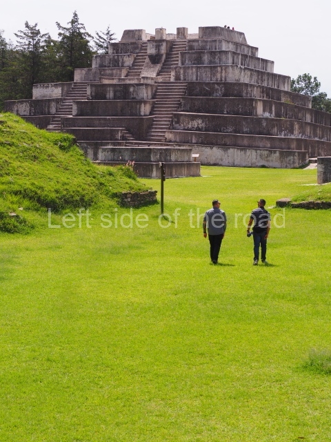
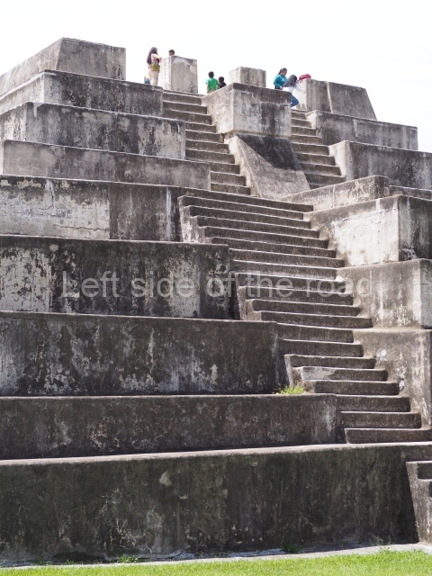
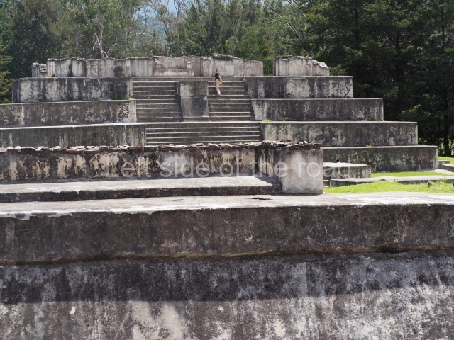
Under the direction of a so-called ‘archaeologist, John Dimick, ‘restoration’ was carried out in the 1940’s – funded by the United Fruit Company, yet another crime to add to what they did in the country. It is argued by some that this was, in fact, what the buildings would have looked like in their heyday.
However, I think there’s little proof of that. Yes, they did use stucco in places and that might have included some of the walls rather than just in decoration. But in all the sites I’ve visited there’s no proof whatsoever that this bland aesthetic was used extensively. If that was the case why had it all fallen off so successfully as to leave no evidence of it being there in the first place. And what has happened to the tons of stucco that would have been at the foot of the buildings?
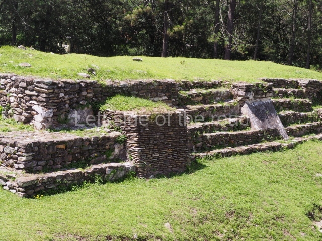
Further, the use of the stone not only as a building material but also in ways which make it anaesthetically pleasing to look at belies the fact that all that effort would then have been covered in such a manner.
Even if there were evidence that the structures were covered so what was the rational to ‘return it to what it was in the past’? There is no definitive proof of how the buildings were finished and the work carried out in the 1940s was done so only because that was Dimick’s theory at the time. And as it was only a theory why did they feel it was necessary to cover all the structures in such a way? Why not use one as an example of the theory and leave further investigation to come up with other ideas?
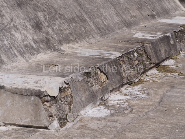
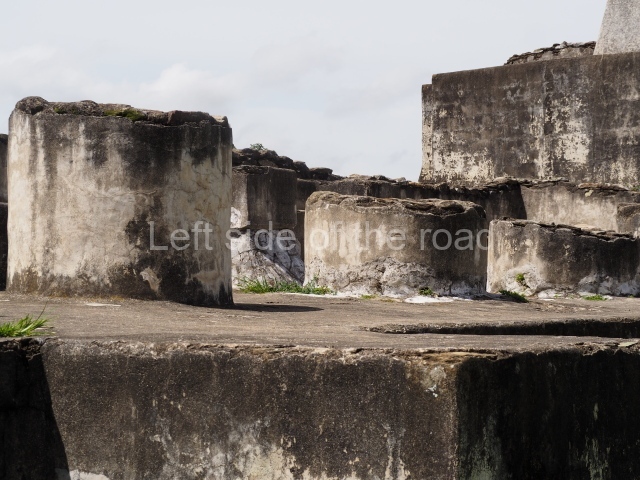
Perhaps further proof that this was NOT the way the buildings looked when they were being used is the fact that the concrete has barley lasted a century and is crumbling in many places. It also looks dirty and I don’t think that fits in with the Mayan aesthetic.
And also their practical approach to architecture. If the concrete isn’t lasting why should the stucco have lasted any longer? And why introduce an aspect to the buildings which would necessitate continued maintenance on a large scale? Repairing some stones is one thing, having to cover the building every so often is another.
John Dimick
Just to show the cavalier manner in which this ‘restoration’ was carried out Dimick wasn’t even a trained and experienced archaeologist. He called himself an ‘archaeological buff’ and seemed to think that just because he had been to a few archaeological sites around the world that this gave him the insight to determine what should happen at Zaculeu. This is not to say that even the most experienced archaeologists can get it wrong but to allow such a major alteration of such a large and important site to such an individual is beyond imagining. From reading a little about him it was more than likely due to the ‘old boys network’ that the United Fruit Company gave him the job.
Location
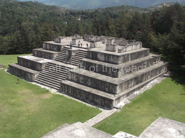
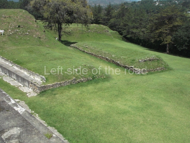
The archaeological site of Zaculeu is situated in western Guatemala, in the municipal district of Huehuetenango, 4 km from the city of the same name and 1 km from the village of Zaculeu. The distances from Guatemala City to Huehuetenango are 266 km (on the CA-1 PanAmerican Highway, via Totonicapan) and 235 km (via Santa Cruz del Quiche and Chichicastenango). The Mexican border (La Mesilla) is 90 km away. All the roads are asphalted. Due to its proximity to the city of Huehuetenango, this site can be reached by car or on foot as there is an asphalt road leading directly to the main pyramid. Zaculeu is situated 1,940 m above sea level at latitude 15° 19′ 58″ and longitude 91° 29′ 36″. The flat, green valley in which the ancient city is situated is traversed by various deep rivers, including the Selegua, west of Zaculeu, and the Vina. To the east and south are deep ravines which contributed to its isolation and made it easy to defend. Practically the only access is a narrow entrance in the north connecting the flat plateau where the ruins stand to the rest of the valley. The Huehuetenango Valley was inhabited long before the creation of Zaculeu, and various places have yielded the remains of a human culture dating from 800 years earlier, from the Early Classic. The city was built in 1480 on a high plateau measuring five blocks and 1,178 yards. The place was chosen because of its status as a natural and practically impregnable fort; defending the city was a matter of vital importance at the time, when the country was being invaded by the Nahua from Mexico and different peoples were at war with each other. The civic-ceremonial core extended over an area of 1,400 sq m and today displays evidence of an exceptional, 800-year-old timeline dating back to the Early Classic. It contains 43 structures arranged in compact groups around small, clearly defined plazas with no particular orientation, corresponding to the Qankyak and Xinabahul phases of the Postclassic. The path that leads to the site enters the plateau via the left end of the narrow access, with a rectangular mound virtually sealing three quarters of the neck. This mound contains the remains of a type of fort that guarded the city’s only entrance. Beyond the narrow entrance, the path continues in a straight line for approximately 100 m until it reaches the base of the great pyramid, the most important monument at the site. Turning right, visitors will see a large plaza measuring 54×38 m, once the scene of the ceremonies to honour the gods to whom the temples were being dedicated. The sides of the plaza were formed by the platforms of four large pyramids situated at the cardinal points.
History of the explorations
Originally named Tzaculeu, it was declared a National Monument of the pre-Hispanic period by government decree on 24 April 1931. On 23 February 1946 it adopted the present-day name of Zaculeu and the United Fruit Company was granted a licence to conduct investigations and excavations at the site.
Pre-Hispanic history
Complex settlements such as Zaculeu, which first emerged in the early classic but experienced its peak in subsequent periods, offer very little information about the architecture: the earliest levels correspond to the Atzan phase (Early Classic) and only reveal adobe floors, greatly eroded sub-structures or terraced platforms, and an early balustraded stairway, all corresponding to Structure 1. The information is completed by the remains of floors associated with a low platform that supported a perishable construction at Structure 13, and by simple floors with ceramic caches at Structure 9. Technically, the principal building material was adobe, although coarse stonework with an adobe mortar was also used and then covered by white stucco. It is difficult to determine whether this region belonged to the East or West Complex because very few reports have been published on the Postclassic ceramics from this area. However, we can make use of the information from the site at La Lagunita, where an important example of Early Classic ceramics was found in an artificial cave on a very similar plan to Tomb 1 at Zaculeu and to two burials found at Nebaj (Tomb 1 in Mound 1 and Tomb 1 in Mound 2).
Postclassic (AD 900-1524).
This era has traditionally been divided into two periods due to the important cultural changes attributed to the great Mexican influence: the Early Postclassic (AD 900-1200) and the Late Postclassic (AD 1200-1524). The research conducted in this region has revealed that this era is conceived more as a stage of continuity and change. It would appear that the Guatemalan plateau did not suffer the same decline in population that occurred in the Maya lowlands during the Postclassic. In fact, the region continued to be densely populated, as the Spanish found when they arrived in 1524. Fauvet-Berthelot has defined a very accurate chronological division for dating the archaeological material and the sites studied, distinguishing three phases: the Epiclassic (AD 850/900- 1100), which marks the transition between the Classic and the Postclassic; the Early Postclassic (AD 1100- 1225); and the Late Postclassic or Protohistoric (AD 1225-1524). After the second half of the 16th century, written documents such as the Popol Vuh and the Anales of the Cakchikels shed greater light on the historical facts.
Epiclassic.
The cultural characteristics of this period reveal a continuity with the Classic. However, the architecture and funerary practices denote Mexican influences. The ceremonial centres that were located on open ground or in the mountains during the Classic era were still populated in the Early Postclassic and maintained the same orthogonal layout, with the monuments facing the cardinal points. Extensions and superimpositions were added to the existing structures, and long platforms were built, prefiguring the elongated houses of the last phase. Stucco was no longer used as a cladding for plazas and monuments. There was also an important change in the funerary customs, marked by the emergence of new religious beliefs, possibly introduced by small groups of Mexican descent. This meant that the Classic tombs had to be desecrated and then either filled in or used again. During the excavations, several imported metal objects were found. The most habitual form of burial was to sit the corpse directly on the floor.
Early Postclassic.
The strong demographic growth during this period was the result of a change in the governing lineages, which ushered in a new political and religious system. In the case of the K’iche’ Maya, the written sources and archaeological evidence suggest that the new lineages came from the Sierra de Chuacus. The socio-political recomposition that they brought about in the river basins and valleys of Q’umarkaj, Cauinal, Rabinal, Salama and others led to the incorporation of new cultural characteristics during this period, a time when numerous elites, proud of their Toltec descent, were migrating to different places all over Mesoamerica. These important changes were manifested in the structure of the population, the architecture and the religious and funerary practices
Late Postclassic or Protohistoric.
From this period, when Zaculeu enjoyed its greatest prosperity, we have various written documents that shed light on the archaeological data. The indigenous and Spanish texts furnish information on the history and social organisation based on lineages within chinamit (districts), the royal dynasties, the dual government, territorial limits, the requests for tributes and the pantheon of the various federations, among which the K’iche’ federation was the most powerful. Pre-Hispanic history has also been preserved in the oral tradition. During this period, the civic-religious centres moved out to hill slopes and elevated points in search of defensive advantages but also, and most importantly, in search of good farming land, sources of water and trading routes. The buildings no longer occupied a polygonal layout but were organised around a plaza, respecting the local geographical terrain. This enabled the leaders to control the land within sight of their base. At every site the political and religious power was rooted in a noble lineage or several groups of lineages, and there was a pyramid with one or several stairways flanked by sloping balustrades and leading to a single or double temple. The latter probably represented the alliance between two groups, whose patron gods were worshipped in the same way. Zaculeu was built by the Maya Mam and means ‘white earth’ (from zac, earth, and uleu, white). It was one of the last citadels of the pre-Hispanic period and comprises two zones or sections that can still be differentiated to this day: one composed of the fortress city with its temples, palaces, plazas, ball court, etc.; and another with a residential area for the common people and crop fields. According to the account by Fuentes and Guzman in their Recordacion Florida from the final decade of the 18th century, King Kaibil Balam locked himself into the fort during the siege by the Spanish, but in 1526 the lack of food forced him to surrender to Captain Gonzalo de Alvarado y Chavez, the cousin of Pedro de Alvarado, attributed with conquering this region. The indigenous peoples in this department belong to four linguistic groups derived from Maya, the common core shared by the peoples and languages of Guatemala. The largest group or nation was the Mam, to which all the towns outside the Cuchumatanes Highlands belong, with the exception of Aguacatan and a few towns in the uppermost part of the mountains: Todos Santos Cuchumatan and the neighbouring towns. The Mam kingdom covered a vast territory, including Huehuetenango, Totonicapan, Quetzaltenango, San Marcos and the province of Soconusco. The cruel battles between the different tribes led to the dismemberment of the territory and following the K’iche’ invasion led by King Quicab ‘the Great’, the Mam race and their Kaqchikel allies were forced to abandon part of their vast domains and retreat to the mountains, most notably to Huehuetenango, Chiantla and Todos Santos Cuchumatan in the Cuchumatanes Highlands. The Mam also occupied Cuilco and the remaining towns in the north-east, where secular and Mercedarian missions were established to ‘civilise’ the Indians.
Site description
The architecture at the site includes temples, fortresses and a large ball court. At Zaculeu there are no hieroglyphic inscriptions on walls or columns, and neither have any stelae, altars or other sculptures been found in the plazas. Nor are there any Maya vaults or other solutions like those used at other sites. The historical accounts accord Zaculeu considerable strategic importance as the capital of the Mam kingdom or domain.
The ceremonial centre.
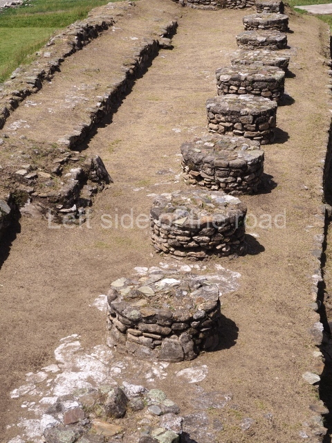
The Mexican influences were very strong at Zaculeu. The research conducted by Navarrete indicates Tula influences in the architecture. This is most notable in Structure 4, which contains a bench-altar composed of a protruding altar in the fashion of a small pyramid with a balustrade culminating in a finial block. Another typical characteristic is the construction of circular structures in the rear sections of the buildings. In the last phase, the building materials were slate and granite, covered with stucco. An imposing bowl-shaped ball court occupies the central position. The tiered pyramids were built in the talud-tablero style with a double stairway, and surmounted by a temple with one or two interior chambers and three entrances delimited by cylindrical columns. The small altars in the plazas adopted the same characteristics as the large pyramids, resembling miniature pyramids themselves. The best examples of a Toltec-style sloping base surmounted by the walls of the super-structures are Structure 1 at Zaculeu and the enclosed ball courts reported by Smith at six other sites.
Funerary and sacrificial practices.
During the Protohistoric, it was customary to burn the leaders and bury their ashes at the foot of important structures. Urns of varying types were used for this purpose and were accompanied by small offerings of metal, such as gold, tumbaga (an alloy of gold and copper) and copper, either imported or made locally. The common people were buried in cemeteries situated on the outskirts of the cities, near their residential groups, in simple cylindrical graves identified by stones. Royal and other important dignitaries were buried with their legs folded against their breast, their arms crossed, their skull (according to their customs) artificially deformed and their teeth selectively filed; sometimes, they were accompanied by offerings consisting of serpentine axes, obsidian blades, jadeite beads and copper rings.
Sacrificial stone slab in front of the temples.
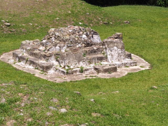
Navarrete explains that there are two examples of sacrificial stone slabs in front of temples but that this characteristic only appears in its entirety at Temple 2 at Iximiche, in front of and in the middle of the central entrance to the precinct. Its discoverer, Jorge Guillemin, described it as follows: ‘The steep stairway leads to the top terrace; near the edge is an altar with a stone slab for sacrifices, measuring 40 cm in height, 45 cm in width and 18 cm in depth, with a slightly concave top, all made out of stone and stucco. Compared with Mexican archaeology, it is clear that this stone slab must have been used for human victims ‘thrown into the arms of Caxtoc’, according to the term used in the Memorial of Solola’. Another example could well be the base of a stone slab very similar to the aforementioned one, found in front of and in the middle of the entrance columns to Structure 17 at Zaculeu; unfortunately, it is in such a state of ruin that it is impossible to make out its original form.
Monuments and ceramics classic (AD 200-900).
Zaculeu contains a black coffee-coloured variety of ceramics, very similar to the contemporary ceramics produced in the Zoque area of western Chiapas, coinciding with a supposedly Zoque linguistic enclave in the Aguacatan region (Awakateco II language). One hypothesis suggests a Mixe-Zoque presence in the middle of, or next to, a Maya population that uses the K’iche’, Poquomam and Q’eqchi’ languages, which have recently spread throughout the region. In any case, this presence, if It exists, is only evidence of a much wider Preclassic occupation whose hypothetical association with the sculptural styles of the Plateau and Coast has yet to be explored. There are also ceramics related to those of Nebaj, Zacualpa in El Quiche and the Early Classic site of Kaminaljuyu in Guatemala City. We can therefore conclude that at least in the Early Classic these ceramics belonged to the West Complex of the western highlands, based on the evident continuity in the pattern of settlement. The region may have continued within the West Complex for at least the whole of the Classic era. Subsequently, the Sajcabaja region appears to have changed its orientation and become part of the East Complex, because in the Late Postclassic the ceramics show stronger ties with the populations in the basin of the River Negro.
Epiclassic (AD 850/900-1100).
Ceramics continued to be manufactured in the same way as during the Classic era but new ritual and funerary types emerged. The innovations included the manufacture of Plumbate Tojil ceramics – characterised by anthropomorphic and zoomorphic vases that idealised the god Tlaloc – and other types imported from the Valley of Mexico. Meanwhile, the imported objects comprise Mixtecastyle tripod incense burners, Fine Orange tripod vases on pedestals, red-on-cream incised tripod bowls, redorange polished bowls with anthropomorphic or zoomorphic moulded supports, and plates and vases decorated with the negative painting technique. The stone-carved sculptures included pieces with butts and stelae with bas-relief decorations; in relation to minor lithics, serpentine axes, grinding stones, pestles and artefacts made of obsidian were all used. Metal also emerged at Zaculeu; the excavations revealed a tumbaga butterfly.
Early postclassic (AD 1100-1225).
The most characteristic ceramics produced during this period correspond to the Plumbate Tojil variety and included bowls, cylindrical or barrel-shaped vases, and jugs with modelled effigies. Perforated tripod incense burners were also made during this period, and there are discs, stamps, whistles and female figurines.
Late Postclassic or Protohistoric (AD 1225-1524).
Chinautla Polychrome ceramics have been found, and although their presence at Zaculeu is somewhat limited they are nevertheless highly representative of other places in the Guatemalan Highlands. Polished monochrome black bowls and vases have also been found.
Patricia del Aguila Flores
From: ‘The Maya: an architectural and landscape guide’, produced jointly by the Junta de Andulacia and the Universidad Autonoma de Mexico, 2010, pp494-498.
1. Plaza 1; 2. Plaza 2; 3. Plaza 3; 4. Plaza 4; 5. Plaza 5; 6. Plaza 6; 7. Plaza 7; 8. Plaza 8; 9. Structure 1; 10. Structure 6; 11. Structure 9; 12. Structure 10; 13. Ball Court; 14. Structure 2; 15. Structure 3; 16. Structure 13; 17. Structure 4.
How to get there:
A bus that goes right past the ruins can be picked up at the bottom end of Calle 2, beside the Salvador Osorio School. Q3.5
GPS:
15d 20’02” N
91d 29’ 34” W
Entrance:
Q50


