Copan
Copan – Honduras
Location
This site is situated in western Honduras, 170 km from San Pedro Sula (three hours by vehicle) and just 10 km from the Guatemalan border. Surrounded by pine and oak-covered mountains, it stands on the banks of the River Copan, which flows east-west to join the Motagua in Guatemala. The altitude is 600 m above sea level and the average annual temperature is 25° C. The Copan Valley is approximately 12.5 km long and 4 m wide. Situated just 1 km from the Main Group is the town of Copan Ruinas, which offers a wide variety of accommodation and food services. Admission to the site costs $15 USD, the same amount to visit the tunnels and $7 USD to visit the Sculpture Museum on the site.
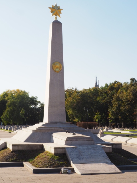
The archaeological area, which gained World Heritage status in 1980, is situated in a part of the valley where the river changes course and flows north-south. The principal plazas are aligned with this axis, albeit with a slight deviation to the east. The core area and adjacent sections occupy 24 sq km. The site has a central area with residential zones distributed around it: Las Sepulturas to the north-east, El Bosque to the south, the present-day town of Copan Ruinas to the west – an important enclave now lost to modern constructions – and the residential area of Rastrojon, a little further away. On the map of the Copan Valley, the main part is situated in square 10L, which is why all the main structures begin with that reference.
History of the explorations
Epigraphers have still not reached a consensus on the pre-Hispanic name of the site, which is represented by a glyph emblem featuring a bat. Copan was the name used by the judge of the Royal Audiencia or Court of Guatemala, Diego Garcia de Palacios, who first reported the existence of the ruins in 1576, in his Description de la Provintia de Guatemala (Description of the Province of Guatemala).
Pre-Hispanic history
Despite evidence of occupation in the Copan Valley since the Early Preclassic (c. 1400-1200 BC), we know very little about these early settlers. By around 1000 BC, the occupants had begun to build great stone platforms for their dwellings and to bury their dead beneath the floors with offerings of ceramics and jade. This settlement might have had links with the Olmecs. There is evidence pointing to the existence of peripheral settlements such as Las Sepulturas and El Bosque from the Middle Preclassic.
The epigraphic texts from the Late Classic make reference to ancient events. Altar I displays a date on its own with no additional references: 7.1.13.15.0 9 Ajaw 13 Kumk’u (14 October 321 BC). On two occasions the end of the Katun 8.6.0.0.0 (AD 159) is also expressed, and stelae 1 and 4 make a vague reference to two dignitaries, one apparently a ruler, K’lNICH-ya- ?-na (Stuart 2004: 219) and another one whose name seems to read Ajaw Foliado. The name of this figure reappears on the peccary skull in Tomb 1 around 8.17.0.0.0, that is 220 years later; we still do not know whether it is a reference to governors with the same name or to a deity. Meanwhile, another date appears in isolation on the jambstone of Temple 10L-7: the Long Count 8.10.10.10.16 (25 March 249). There is also mention of a dignitary whose first name suggests that he may have been a ruler: K’inich Taj Wayib appears on a mask in the Yehnal Structure, and K’inich Wayib on a glyphic step on Sub-Structure 10L-11; this may be a reference to the name of a previous ruler that was subsequently taken by the second ruler, or to the Sun God. Building activity increased around AD 250, but despite evidence of several platforms and paving-stone constructions beneath the Central Acropolis, it would seem that Copan had still not become a consolidated political centre. The references to the 2nd and 3rd centuries AD are probably associated in some way with the decline at that time of the Ch’olana population at Kaminaljuyu, and the construction material used at Copan at this time, as at Kaminaljuyu, was clay. However, although there are remains from a very early date of goods imported from the Guatemalan Highlands, the evidence is insufficient to confirm that the population of Kaminaljuyu emigrated to this site. What is certain is that the course of the history of Copan changed abruptly around AD 426 when K’inich Yax K’uk’ Mo’ (Great Sun First Quetzal Macaw) founded his dynasty, ushering in a period of development at the site and in the surrounding region. K’inich Yax K’uk’ Mo’ was not from the Copan Valley. Due to his circular eye pieces and quadrangular shield, he was initially thought to have come from Teotihuacan, but now, following analysis of what are probably his human remains in the Hunal Tomb, we know that he spent his childhood and adolescence in central Peten. The texts refer to him as an outsider, as the ‘Lord of the West’, who around the year AD 416 celebrated a royal ritual in an unidentified place. Nearly 10 years after that ritual and 152 days before arriving at Copan, he took the sceptre of the K God and became king.
Accompanied by other rulers, including the governor of Quirigua, he then took the sceptre to a building identified as wi te’ naah (root-tree house), related to the dynasties and seemingly of Teotihuacan origin . It would appear that there was an unidentified supraregional power that accommodated and approved the designation and enthronement of kings at different sites; this was the case of the Motaua region during at least the first half of the 5th century AD. K’inich Yax K’uk’ Mo’ then reached Ux Witik, one of the most important ancient names for Copan, and established a long dynasty of 17 rulers that lasted nearly 400 years and made constant reference to him, the founder. K’inich Yax K’uk’ Mo’ was buried 2 m below the floor of a structure that the archaeologists have called Hunal, one of the first buildings of what would subsequently become the Central Acropolis, specifically Structure 10L-16. This is in the Teotihuacan style as it is based on the talud-tablero pattern, although in this case one of the walls of the rooms rises from the panel (tablero) of the only platform. Judging from the characteristics of the rooms, whose remains reveal evidence of mural paint, this structure must have been used initially for residential purposes and was then turned into a tomb for the site’s most important occupant. The remains found correspond to an individual aged between 55 and 70, and the bones have different fractures that subsequently healed, which is typical of a warrior. A few short years before the accession of K’inich Yax K’uk’ Mo’, three groups were built: the Early Acropolis, the North-East Group and Sub-Group 10L-26. These appear to correspond to the residential area with ritual aspects, the palatial section and a temple area, and the ritual ball court. These structures were subsequently incorporated into a single construction, beneath the present-day Great Acropolis. The buildings reveal different techniques and styles: adobe, paving stone and masonry, as well as the Petdnstyle apron slopes and the aforementioned taludtablero. The initial ball court had four stucco macaws, the middle section of each bore the head of a plumed serpent with a right arm in its mouth marked with what looks like a numeral represented by a circle or dot; the meaning of this has not yet been deciphered. Although of modest proportions, the building activity promoted by the dynastic founder is nevertheless highly significant in that its various styles and techniques denote cultural diversity, the site’s links with other places, and the numerous resources at its disposal.
By AD 437 the founder’s son was on the throne, but the glyphs representing his name have not yet been deciphered. He is known as K’inich Popol Hoi (Radiant Mat Head), a name coined from the plaited design of his name glyph, an aspect associated with Teotihuacan. Two years earlier, he and his father had built the initial version of a new group of buildings: the Ball Court, structures 10L-11 and 7, and the superimposed structures Yax and Motmot, which are situated beneath the Hieroglyphic Stairway or Temple 10L-26; the central and lateral facades of the Motmot platform display the apron slopes or taludes typically found in central Peten. This commemoration was celebrated at the end of Baktun 9, in the Long Count 9.0.0.0.0, corresponding to AD 435, and it was recorded by means of the Motmot Marker, which sealed a tomb in the building of the same name. This tomb is popularly known as the Shaman’s Tomb because of the animal remains and three skulls found inside it, as well as the remains of a young woman who must have been admired by the rulers but about whom we have no additional information. The marker depicts the two rulers celebrating the commemoration of the buildings and the ritual sacrifice of a deer, whose remains were deposited inside the tomb when it was reopened at a later date.
K’inich Popol Hoi also built the Papagayo Structure, which covered the Motmot one, and erected Stela 63 In memory of his father. On top of the Hunal structure In the Acropolis, he erected a new building whose entrance faced west (the previous one had faced east), an aspect that was preserved until the final version of 10L-16, and he substituted the talud-tablero style for the sloping apron. Known as the Yehnal Structure and adorned with masks of a dignitary or deity mentioned or identified as K’inich Taj Wayib, it contains the Margarita Tomb, with the remains of a women aged between 50 and 60 who spent her childhood in the Copan region. Due to the rich offering and its proximity to the founder’s tomb, archaeologists believe that the remains belong to K’inich Yax K’uk’ Mo’s wife and that this alliance enabled him to strengthen his kingdom by creating bonds with the site’s elite. The tomb was reopened on numerous occasions to worship the remains inside it, and they even created a special entrance when new constructions obstructed the original one. K’inich Popol Hoi seems to have demolished this Yehnal structure and built a new version, the Margarita Building, decorated with extraordinary stucco panels depicting the figures of two birds with intertwining necks: inside the mouth of each bird is the representation of the Sun God (K’inich) and above each head the Yax symbol. One of the birds is a quetzal (K’uk’) and the other a macaw (Mo7), thus reflecting the name of the dynastic founder. Beneath each figure is the Imix symbol with the numeral for 9, while on another panel the symbol is Kan and the numeral 7; these dates are inscribed beneath the feet of the dignitaries on the Motmot Marker but we are still not sure what they refer to. Margarita was surmounted by yet another building, the Xupki, although it was almost completely destroyed by subsequent structures. The Xupki Stone, a monument associated with this building, was found in the Margarita Tomb, although it previously occupied a different location; once again, it refers to the dynastic founder and his son. The intense building activity promoted by the second ruler would continue with the subsequent monarchs. Copan almost certainly achieved the wealth to finance this expansion by trading the resources furnished by the Motagua Valley, which stretches from the Guatemalan Highlands – with large deposits of obsidian – to the Caribbean. Furthermore, the Copan Valley is practically the only source of jadeite in Mesoamerica. The celebration of the end of Baktun 9.0.0.0.0 was an important event for Copan, although for some reason very little mention is made of it in the other Maya inscriptions that celebrate the ending of a cycle. The fact that several references at Copan allude to this event being celebrated in the presence of K’inich Yax K’uk’ Mo’ and, in the earliest reference, to the Motmot Marker being presented by him and his son, has raised the question about which of them was on the throne at the time (AD 437). Although we do not have the definitive answer, it would appear that Ruler 2, K’inich Popol Hoi, was the governor and that his father was probably still alive and had transferred his power to him, K’inich Popol Hoi.
We know little about Ruler 3. Altar Q, which lists 16 governors, is of little help because the glyphs corresponding to this figure are greatly damaged and there are no dates to situate his reign. We also know little about Ruler 4, K’altuun Hix: he modified the shrine in the Papagayo Structure, underneath Temple 10L-26, by placing an altar with a dedication in front of Stela 63. The altar is probably dedicated to K’inich Yax K’uk’ Mo’, to whom the stela makes reference. Of rulers 5 and 6, the only thing we can infer is that the latter was no longer the governor in AD 524 when his successor controlled Copan’s fate. However, we do know that all of them added to the constructions at the Acropolis and the North-East Group. New structures were built on top of the Hunal Tomb – underneath Structure 10L-16 – called Chilan and Celeste. By AD 470, the Acropolis platform had reached a height of 5 m above the level of the River Copan and covered several earlier structures. It would eventually grow to 10 m. In the North-East Group, the platforms were widened and the structures became taller; this group finally adjoined the Acropolis and was connected to the Papagayo Temple.
Ruler 7 was Bahlam Nehm (Jaguar Mirror) and his reign lasted from at least AD 524 to 532. He erected Stela 15, which commemorates the half Katun in the year of his accession. He is the only Copan dignitary mentioned elsewhere, aside from the constant allusions to Quirigua. Arguably, there is also a reference to the dynastic founder on the sculpture known as the Man of Tikal: specifically, on Stela 16 at Caracol, which is dated to two years after his death. His constructions continued to raise the height of what had been the North-East Group.
Ruler 8, Wi’ Yohl K’inich, came to power in AD 532 and is known as the great builder. He expanded the Acropolis and took it to its penultimate phase. He built the Indigo Structure, the first one with masks of the earth monster and the precursor to the masks on Structure 22; and also the Ante Structure with a sloping apron in the Peten style, which according to the inscription on the step was consecrated in AD 541. This structure contains a ritual bundle with elements of air, earth and water, the three layers of the Maya cosmos. He also completed an expansion of the Ball Court, known as the IIA phase. In AD 571 he began what was at the time the city’s tallest building, the Rosalila Structure. Completed around 655, this consists of three tiers and is covered by several layers of stucco, the final one in red, with an impressive decorative repertoire of masks and reliefs in yellow, white and green. It has been preserved almost in its entirety beneath Structure 10L-16 and there is a reproduction in the Sculpture Museum at the site. This governor’s reign ended in 551 and he was probably buried in the Sub-Jaguar Tomb. In nearly 20 years on the throne, he witnessed a dramatic change in the region: deforestation made it impossible to go on producing stucco in large quantities because enormous supplies of timber were required to burn the limestone. Thereafter, Copan would be obliged to decorate its constructions with stone sculptures – which must have necessitated considerable quantities of flint and other such materials – and abandon the extraordinarily rich earlier sculptures modelled in stucco.
The ninth ruler’s reign was short-lived and his name has not been deciphered. In AD 553 Copan gained its tenth ruler, Moon Jaguar, the son of the seventh. He is known from two stelae that appeared in the presentday town of Copan Ruinas, a former suburb of the Maya city: stelae 17 and 9, dated in AD 554 and 564 respectively. During the 25 years of his reign, this ruler must have built the last structures in Court B, underneath the present-day East Court. He was probably buried in the Galindo Tomb that Juan Galindo explored in the early 19th century, situated south of the Ante Structure and nowadays visible thanks to the present-day tunnels.
In AD 578, Copan Butz’ Chan (Smoke Sky) acceded to the throne and reigned for 49 years. Stelae 7 and P make reference to him: the first, found in Copan Ruinas, celebrates the end of Katun 9.9.0.0.0, corresponding to AD 613; the second was relocated in the West Plaza. In both cases, the inscription is barely legible. At Pusilha in southern Belize, a governor took the same name after the reign of the Copan ruler. Butz’ Chan Filled in Plaza 2B and the structures built by his predecessors, creating what we now know as the East Court. He was succeeded by another prominent ruler, known by the name of Smoke Imix and nowadays identified as K’ahk Uti’ Witz’ K’awiil (Martin and Grube 2008: 201). His reign was the longest, commencing in AD 628 when he was 24 years old and ending 67 years later. His longevity (nearly 91 years) was constantly referred to and he came to be known as the Lord of the Five Katuns or 20-year periods. He built a few temples in the new East Court at the Acropolis, as well as Structure 10L-2 on the north side of the Great Sun Plaza. He also completed the Rosalila Temple and began to build the long Chorcha Sculpture at Structure 10L-26 on top of the Masks phase and part of the Papagayo adoratorium; the rich tomb found inside Chorcha, known as the Scribe’s Tomb because of the archaeological evidence of a codex, 44 vessels and other miscellaneous remains, probably belongs to this ruler. His power enabled him to erect seven hieroglyphic monuments in AD 652 (stelae 2, 3, 10, 12, 13, 19 and 23), not only in the central plaza but also throughout the rest of the valley. There have been various speculations about this layout but none confirmed because the glyphic texts that cover four of the stelae from top to bottom are proving very difficult to translate. The same date is mentioned on Altar L at Quirigua in association with an event known as the little understood tzak huli (plotted arrival). He subsequently erected another nine monuments, stelae I, 1, 5, 6 and E, and altars H’, I’, K and 5. A ruler at Pusilha appears to have taken his famous name after his death. At this time, the representation of rulers on the stelae began to change slightly but deliberately, resulting in disproportionate faces in relation to their bodies. This is one of the distinctive characteristics of Copan.
At the peak of its golden age, Copan found a worthy successor to Ruler 12: in AD 695 Waxaklajuun Ubaah K’awiil (Eighteen Images of K’awiil) acceded to the throne and his long reign has been defined by a dynamism in building and political activities and the development of art and, almost certainly, the economy. He completed the delimitation of the Sun Court by erecting several of the site’s finest stelae and Structure 4 with its radial stairways. After years as the main structure, the Rosalila Temple was carefully covered, except for the top tier, with a thick layer of white stucco to protect its wonderful reliefs and then filled with mud and pebbles. On top of it, at the beginning of the 8th century AD, was built what is nowadays known as the Purple Building, the penultimate stage of the present-day Structure 10L-16, thus continuing the veneration of the dynastic founder. Very little of this stage has remained as most of it was demolished during the final stage. In honour of his predecessor, in 710 he built the Emerald Structure underneath the present-day Structure 10L-26, which he once again expanded in the penultimate version and changed the east facade, which contained the first version of the Hieroglyphic Stairway. The text states that ‘built are the steps of the tomb of the lord of Copan’ and indicates that it is his father’s funerary monument. In the main acropolis, he built structures 20 and 21, now lost as a result of the landslide caused by the River Copan, and in 715 he erected the imposing Structure 22, with a glyphic step and the representation of the enormous mouth of the earth monster, as well as a clear reference to the underworld and the upper stratum supported by two bearers on the earth level. This level coincides with the bench on which this prolific governor once sat. He also renovated and then in 738 expanded (AIII) the Ball Court to its present-day dimensions. He dedicated stelae J, C, F, 4, H, A, B and D, as well as Altar S. The sculpture of these monuments, with an emphasis on reliefs, marked a period of particular development in this art. The depth of the sculpture and the rich repertoire of Maya iconographic elements offer a fascinating insight into the exuberant representations created by these people. Meanwhile, the texts also explore new variations in layout, often being inscribed within circles of ropes or a diagonal pattern within circles of ropes or a diagonal pattern. In AD 709 there appears to be a reference at Nim Li Punit to Copan and the use of the turban headdresses typically worn by the Copanec kings, in addition to the use of names of their predecessors at Pusilha. However, despite the frequency of the latter aspect, the other references make this link clear; for example, a Waxaklajuun Ubaah K’awiil governed Naranjo around 814, but there is no connection to Copan. By 718 he had subjugated and burned a site called Xkuy, which archaeologists have not yet located, and six years later we see the accession to the throne of the governor of Quirigua, K’ahk’ Tiliw Chan Yopaat, the latter city having been controlled by Copan since the days of the dynastic founder. In 731 he dedicated Stela A, on which a somewhat illegible inscription makes reference to four of the most prominent and influential cities in the Classic Maya world: Tikal, Calakmul, Palenque and, naturally, Copan. But Waxaklajuun Ubaah K’awiil met with a tragic fate: in 738 he appears to have been attending an event at Quirigua with K’ahk’ Tiliw, the same governor he had appointed 14 years earlier, when he was suddenly captured and decapitated six days later. The version referred to years later on the Hieroglyphic Stairway of Temple 26 at Copan is somewhat less drastic: ‘his breath expired in battle’.
Copan entered a critical period and hardly any monuments or structures were built over the next two decades, which suggests that its entire system changed. The wealth acquired from the River Motagua trade route ceased to flow into the city’s coffers, giving rise in the meantime to the expansion of Quirigua. It Is not clear whether Copan was subjugated to the latter city, but the long dynasty took 39 days to appoint a successor, K’ahk’ Joplaj Chan K’awiil (Smoke Monkey), who ruled for 11 years. Some authors believe that the only thing he built during his reign was Structure 22A, regarded as a Council Room or Popol Nah because of the mat reliefs and glyphs that decorate its facade.
Copan’s crisis affected the beginning of the reign of Ruler 15, who was the son of the former governor and went by almost the same name, K’ahk’ Yipyaj Chan K’awiil (Smoke Shell); he ruled for 12 years and launched new building works. By AD 756 he had completed a new version of Structure 10L-26, duplicating the height of the Hieroglyphic Stairway and once again orienting the facade towards the west. The sculptures interspersed on the steps and the text of the upper temple display certain Teotihuacan characteristics, demonstrating that the Copanec dynasty once again turned for inspiration to the powerful city that wielded such a strong influence in Mesoamerica and was abandoned in AD 650. This ruler must have maintained important diplomatic ties because during his reign a woman from the royal dynasty of Palenque arrived in Copan, probably to marry him. K’ahk’ Yipyaj erected stelae M and N opposite structures 26 and 11 respectively, both of which are of an extraordinary quality.
Ruler 16, Yax Pasaj Chan Yopaat (Rising Sun), controlled the fate of Copan between AD 763 and 810, although we do not know the exact date of his accession to the throne. Neither do we know what happened to the relations with Quirigua (still enjoying its golden age, manifested in magnificent sculptures and constructions) or who controlled the Motagua trade route. Proud of the lineage of his mother Chak Nik Ye’ Xook, the Palenque woman, Yax Pasaj carried out a vast building programme. This included temples 10L-11, 21A, 19, 20A, 29 and 32, as well as the final version of the impressive Temple 16 with its sculptural programme distinctly inspired by Teotihuacan, like Temple 26 built by his predecessor. Temple 18 furnished what is unquestionably his tomb, albeit totally empty. This ruler also built structures 10L-32 and 30, the most important constructions in the Cemetery Group south of the Acropolis, his place of residence. In terms of monuments, he appears to have preferred small formats, a sign that the crisis was affecting the entire Maya world. He commissioned stelae 8, 11 and 29, as well as 17 altars: Gl, G2 and G3 in the Sun Plaza; O, R, T, U, V, Z, B’, C’, D’, F’, G’, W’ and 41; and the most famous one of all – Altar Q opposite Structure 16, which depicts the dynastic founder Kinich Yax K’uk’ Mo’ in the company of the 14 other rulers of the city. The remains of 15 jaguars were found underneath this altar.
Yax Pasaj would experience the most critical years of his city and culture. He strengthened his ties with Palenque, not only in references to his mother but also in the reliefs on Temple 18, where he is depicted in his warrior garb for war – a situation that is further reinforced by the previous three rulers shown with him in a distinct reference to the conflict with Quirigua. Meanwhile, Stela 11 portrays him as an old and bearded Maize God, on top of the mouth leading to the underworld. He insists particularly on his political standing by showing himself accompanied by his 15 predecessors on Altar Q and in the company of deities and important rulers on an interior step in Temple 11.
There is evidence that certain dignitaries from the suburbs and nearby communities also began to erect their own monuments, an indication that royal power was no longer absolute or centralised. Although this is particularly clear in the Group at Las Sepulturas, there are also signs of this phenomenon in the present-day town of Copan Ruinas, and even in nearby sites such as Los Higos and Rio Amarillo there are dignitaries with the title of Ajaw or Lord. The deforestation that had commenced a century earlier continued with the terracing of increasingly high slopes to obtain better harvests; these efforts were in vain, however, because the burials corresponding to this period show clear signs of malnutrition and disease. The crisis was also reflected in the culture: the sculptures and final texts lost both clarity and quality in their finishes, and important events were increasingly recorded in smaller, much less refined formats. The architecture evolved from the monumental structures 11 and 16 to the relatively small Temple 18, which was Ruler 16’s own funerary group. In view of the decline of royal power, if not of the population, this Copan governor travelled to Quirigua as a guest to commemorate the end of the Long Count period 9.19.0.0.0 in the year AD 810: the ancient powers no longer had the strength to oppose each other and joined their weak forces to commemorate the ancestral worship of passing time.
We do not know the exact date of Yax Pasaj’s death. Stela 11, which dates from around AD 820, refers to the ‘disappearance of the Founder’s House’. The last precise reference is the aforementioned event at Quirigua. His successor, Ukit Took’ (Patron? of Flint), only left us one monument that appears to commemorate his accession to the throne in the company of his predecessor on 6 February 822. This is Altar L which has only one complete side (south) and just the beginnings of a sculptural programme on another side (north). Due to the lack of additional text we cannot confirm that he was a ruler, although the format and the garments are typical of the city’s governors. The collapse of the dynasty seems to have been so sudden that he was unable to complete the sculpture.
There is evidence that the Cemetery Group situated south of the Acropolis and identified as the residence of Yax Pasaj Chan Yopaat was vandalised soon after his death, and that important structures in the group, such as 10L-29, 33, 22 and 41, were burned; this was especially the case of the lintels, which caused the vaults to cave in. The most important building in the group, 10L-32, was cleaned in the late 19th century and is thought to have suffered a similar attack. No one knows who was responsible, although there has been speculation about an uprising of the noble families at Copan itself.
However, as there is no evidence of similar violence at Las Sepulturas or other districts of the city, nor in the main Acropolis structures, the situation remains unclear. Naturally, no new epigraphic data survived, although the archaeological record indicates that immediately after the attack on the Cemetery Group people continued to live at the site – the same settlers using the same type of ceramics – but were unable to restore the damaged structures.
The population crisis deepened. Towards the end of the 9th century, the city had approximately 26,000 inhabitants, but this number gradually dwindled until the site was finally abandoned around AD 950. Certain historians suggest that this actually occurred around 1250, basing their estimations (not totally accepted) on obsidian hydration. In the Postclassic, foreign settlers created shallow burials in the Central Acropolis and occupied the El Bosque Group, 100 m south of the Acropolis, where Ball Court B is located. They built platforms 20 m long and just 1 m high, and roofed them with perishable materials; they are arranged somewhat haphazardly and constructed out of stones from earlier structures. Overall, they denote a very poor technology that has nothing in common with the magnificent structures produced during Copan’s golden age. They also looted tombs and reused sculpted stones from the Acropolis. There is no evidence of these settlers outside the El Bosque Group, and the latest dating exercise situates them around AD 990-1020.
Site description
Situated at the entrance to the site is the Copan Sculpture Museum. On the left-hand side, near the ticket office, is a model of the core area of the site. A long path leads to the Great Plaza. This and the Acropolis are the areas open to the public.
Great plaza.
This extraordinary space with a stairway around most of its perimeter comprises the Sun or Stelae Court to the north, the Hieroglyphic Stairway Plaza to the south, the East Court and the Ball Court. The Sun Court takes its name from the solar phenomena – equinoxes, solstices and the passage of the sun over the zenith – which are marked by several of the seven stelae, 11 altars and Structure 4 situated there. The latter is a small square-plan, radial pyramid with free-standing stairways on every side, formed by four vertical tiers. Two groups of sculptures can be found in the Sun Court, one in the middle comprising stelae I, A, 4, B, C, E, D, F and H, with their corresponding altars and the independent Altar G; Stela 3 was erected on the south side of Structure 4. The tour of this area continues to a platform on the north-east side of the Sun Court, with Structure 3 at the east end and series of structures on the north side. The most outstanding of these are the steam baths with their unmistakeable engineering. Meanwhile, the East Court or Middle Plaza is virtually devoid of elements, which means that it is difficult to infer its function. At the north-east end stands the unusual Stela J, whose altar marks the boundary of the central court.
The Ball Court consists of a square platform that seals the north and north-east ends; the north end is higher and situated at its uppermost points are Stela 2 and Altar L. The rear part of the sloping sides of the court are formed by structures 9 and 10. The former occupies the west side and has its own access from the west, opposite which stands Stela 1; on its other three sides it has stairways. The top entrance is defined by a portico with three accesses leading to a large bay; in the middle of this area, a corridor leads to another identical portico at the west end. Situated on the north and south sides are the entrances to the double-bay rooms; all the vaults adopt the form of inverted stairs, albeit with a longer springing line. Meanwhile, the uppermost section of Structure 10 situated behind the east slope displays a similar design with an elongated room overlooking a central corridor that runs from one side of the construction to the other; it also has two bays at the north and south ends, but in this case containing a single, narrow room with similarly stepped vaults. The part of the facades that once overlooked the court were decorated with slightly sloping friezes, on which there were fabulous stone reliefs of macaws with their wings extended and their tail projecting upwards. Their open claws pointed down, sculpted in high-relief, almost in the round but embedded into the frieze, while their heads and open beaks rose erect in all their majesty. The principal decorative motif for the court seems to allude to various birds associated with the sun, and to the founder of the Copan dynasty. Only one of these birds can be admired in situ, but the remainder are on display in the Sculpture Museum. In fact, visitors can only see four of the original eight birds, four on each side of the court, two perched on pilasters and two at the front corners. The frieze culminated in a moulding with sculpted motifs and four merlons above each macaw, which again are now on display in the Sculpture Museum.

Copan – Ball Court
The Ball Court is one of the finest examples of Maya architecture and one of the most important structures in the principal group at Copan. It achieves a special effect thanks to the gentle gradient of its slopes or taludes, which is further enhanced by a light moulding running vertically through the centre and by the three markers, shaped like macaw heads, embedded in the top; a rear bench culminates half a metre from the lateral end of the slopes, leaving the four markers as imposing free-standing elements. All of this lent a sense of lightness to the slopes, liberated at the ends, with the prominent head-markers and the eight macaws surveying the scene from the friezes of the upper structures. The circular markers embedded in the ground, decorated with reliefs of deities and Ruler 13, Waxaklajuun Ub’aah K’awiil, completed the court. These are now on display in the museum in Copan Ruinas. Subsequently three other markers, now greatly eroded, were erected, and finally three quadrangular markers, all totally damaged.
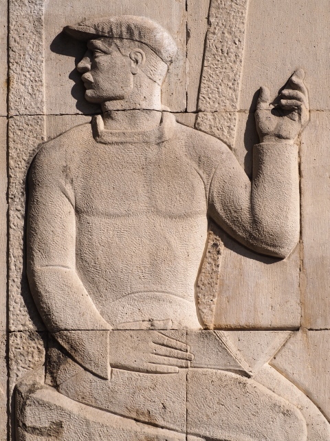
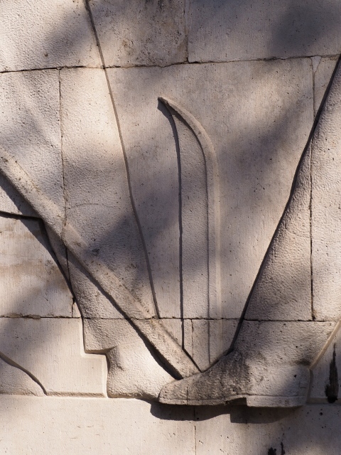
The Hieroglyphic Stairway Plaza lies south of the Ball Court. It takes its name from the facade of Structure 10L-26, along its east side, where the steps in the stairway boast the longest Maya hieroglyphic text known to date. The inscription narrates the long succession of Copan rulers, from the founder of the dynasty, K’inich Yax K’uk’ Mo’ (AD 426), to the reign of ruler 15, K’ak’ Yipyaj Chan K’awiil (AD 755). Embedded in the steps of the stairway were six magnificent sculptures. All except one of these life-size representations of some of the city’s rulers are seated in a relaxed yet solemn pose, denoting great strength.
The structure consists of 11 tiers with a band of moulding along the top edge. At the top of this imposing structure there once stood an interesting temple, whose facade displayed a varied and complex warrior decoration encompassing sculptures of hearts, rectangular shields, masks with Tlaloc characteristics and warriors in groups of six; inside the temple, a hieroglyphic text offers a short narrative of the dynastic sequence up to Ruler 15, accompanied by glyphs that are reminiscent of the Teotihuacan style, totally unlike the symbols commonly used on the plateau, probably a type of pseudo script. Both the decorative remains and the glyphic text are nowadays on display in the Sculpture Museum. In front of the construction stands Stela M, which depicts Ruler 15 and his altar. One of the sub-structures yielded the funerary temple of K’ahk Uti’ Witz’ K’awiil – now known as Smoke Imix – which contained, among other items, the magnificent incense burners representing the 12 rulers that had governed Copan to date; these are currently on display in the museum in Copan Ruinas. Flanking the south side of the Plaza is another enormous stairway composed of megaliths and surmounted by Temple 10L-11. This structure has its own stairway and is preceded by Stela N. In fact, this would be the formal entrance to the restricted area comprising the main Acropolis and adjacent plazas. Nowadays, access is via a path on the west side.
Acropolis.
Structure 10L-11, whose facade dominates the whole of the Great Plaza, is a singular construction. Two corridors cross it from east to west and north to south and the walls flanking each of the four entrances were decorated with an inscription relating to the accession of Ruler 16, Yax Pasaj – some of the glyphs arranged in an inverted reading order, as though a mirror reflection – and sculptures of the city’s governors. This building only had access stairways on the two lateral sides and the main facade overlooking the Great Plaza, where an imposing platform divides the main stairway. The rear corridor depicts the gaunt jaws of an indistinct animal; a similar representation can be seen from the south side. This corridor leads to a platform overlooking the West Plaza. At the front of this platform, a ceremonial bar culminates at each end in the head and front legs of an animal. The first flight of the stairway at the west end of the south facade leads to a wide corridor and a series of niches, which from a distance look like entrances leading to the interior of the structure. Decorating the corridor are sculptures in the round of alligators and snails. The second, narrower flight of the stairway leads to the platform preceding the west access to the building. A second stairway situated further east and known as the Tribune of the Spectators falls about a metre short of the niche level. The highest step is decorated with a glyphic band and flanked by Pawahtuuns, or groups of deities, carrying torches inscribed with the glyph Ik. The large heads of these dignitaries were found in what must have been the rubble of the top frieze.
The West Court is composed of the non-consolidated structures 13 and 14: the first is a platform and the second is flanked by altars I and H. The famous Structure 10L-16, dedicated to the founder K’inich Yax K’uk’ Mo’, dominates the court with its stairway. All the sculptures on the stairway, with Teotihuacan characteristics such as representations of Tlaloc, are on display in the Sculpture Museum. The structure has been extensively excavated through tunnels, which have shed light on earlier sub-structures such as the famous Rosalila Temple. The so-called Hunal Tomb, thought to be the burial place of the dynastic founder, was also found on a lower stratum, as was the Margarita Tomb, probably belonging to his wife. The temple at the top, which is not open to the public, had four entrances, one on each side, and numerous sculptures of Yax K’uk’ Mo’ and Teotihuacan motifs. Altar Q stands in front of this building.
A stairway next to Temple 16, which has a replica of Stela P, leads to the top tier of the Acropolis, Platform 15. This overlooks the East Court and its three markers, which are also closed to the public. A two-tier stairway runs down from the platform: the top tier is narrow and divided into two parts by a platform that follows the top level and has a sculpture of the Sun God on its lower section; the lower tier is considerably wider, although it has no practical function. Two jaguars flank the sides of the stairway.
At the north end of the West Court, beyond a stairway covering the side, are three important temples: 22A, 22 and 21A. Temple 21 originally stood beyond these but was lost after the partial collapse of the Acropolis at the beginning of the 20th century. Temple 22 is the largest and most important. It has a large two-tier platform with moulding along the top, while the front projects in a U-shape, flanking its own stairway that culminates in final step decorated with reliefs and a platform that serves as the lower jaw of the earth monster, with two prominent canines and a row of lower teeth. Each corner of the structure has two masks, one on top of the other, of the earth monster, greatly resembling in design and layout those of the Puuc architecture in Yucatan. The facade frieze must have been richly decorated, and it is still possible to see sculptures of the young Maize God, like the one on display in the museum in Copan Ruinas. The temple displays a recurring pattern of residential structures: one room leads to two lateral chambers with low benches and in front of it is an ornate bench leading to the central room. The interior spaces had a high ceiling vault that sprang from an inverted stairway and then became concave. Beneath the bench is a band of glyphs interspersed with skulls that allude to the underworld; two bacabs or sky bearers flank the entrance to the main room while a wavy band across the upper section serves as the body of a two-headed serpent.
Situated on the west side is Structure 22A, known as the Popol Nah or the House of Council, whose upper facade depicts geometric patterns representing a mat; it once contained glyphs alluding to communities or districts that were part of Copan, as well as a few dates from the ritual calendar. Behind Temple 22A stand the ruins of the temple that once graced the top of Structure 26; situated between the two buildings is Structure 230, which has the same design of interior rooms. It was once decorated with bones and skulls but these are now on display in the Sculpture Museum. Returning to the East Court, situated on the west side of Structure 22 is Structure 21A, which has two bays side by side; beyond it are the ruins of Temple 21, known as the Temple of Knives because of the sculptures associated with it. Structures 20 and 19, whose main facades faced west, once flanked the west side of the court but were lost to the river. Temple 20 is known as the House of the Bats after the sculptures of these animals that were found there but are now on display in the site museum. Life-size sculptures of jaguars stand on the platform preceding these temples. Situated at ground level are the tunnels leading to the sub-structures of temples 22, 21A and 20; the tunnels come out at the gap left by the landslide, revealing the stratigraphic sequence of the Acropolis. It is also possible to see the Ante substructure with its Peten-style apron moulding, masks and glyphic steps. The entrance on the south side of the plaza leads to the sub-structures of Temple 10L16, permitting a view of the partial remains of the Rosalila Temple and other constructions.
The East Plaza narrows to the south and on the east platform stands Building 18, the intact funerary monument of Ruler 16, Yax Pasaj Chan Yopaat, whose crypt is open to the public. The temple at the top has entrances on the north and south sides, framed by ornate reliefs depicting the ruler as a warrior. These reliefs are repeated on the jambstones. Inside, a north-facing bench is also decorated with reliefs. Proceeding southwards from the Acropolis visitors reach Building 29, an L-shaped structure. Its facades, nowadays partly reconstructed and on display in the Sculpture Museum, show wavy motifs that represent smoke or clouds, large sun disks inscribed with a fascinating but unidentified dignitary, and a geometric symbol which on the Mesoamerican plateau signifies the year, combined with two binder-mouldings of groups of rods positioned to form the letter X. This latter symbol can also be found in certain inscriptions on Altar Q and although it is crucial for understanding the origins of the dynasty it has yet to be deciphered.
Cemetery group.
This is situated further south and is actually a residential zone for the Copan elite. The most visible parts of the group are structures 32, 43 and 40, the first two of which are residences. Structure 32 comprises a main upper section which again has an inner room with two lateral bays and a main bench in front of it. At the sides, on a lower level, are two entrances to double bays arranged side by side. Each side of the platform and the structure panels were once adorned by a monster mask, and at the top there were three sculptures seated on a sea monster, probably representations of Yax Pasaj. Situated to the west of this building is Structure 33 whose decorative motifs once again take the form of binder-mouldings with X-shaped rod arrangements, this time associated with Tlaloc eye pieces and the plateau year symbol on the friezes.
Sepulturas.
This group situated north-east of the Central Acropolis, to which it was connected by a sacbe or causeway, is a residential district with an ancient occupation sequence dating back to the Early Preclassic. It enjoyed a certain degree of splendour in the Middle Preclassic, and during Copan’s golden age, from AD 400 to 800, it became an enclave for the elite, with large residences arranged around courtyards. Some of these residences appear to have been occupied exclusively by individuals from central Honduras, a region with strong commercial ties to Copan. There are structures of considerable size whose benches have carved glyphs and other motifs; this is unusual because these were normally reserved for the ruling group and the Central Acropolis. The most famous structure is the so-called House of the Bacabs or Palace of the Scribes, identified as 9N-82, which had sculptures of the owner holding a conch-shell ink pot in his hand. The lower bench displays the date of dedication as AD 780, seemingly supported by columns with bacabs, a clear allusion to Ruler 16, Yax Pasaj. In Structure 9M-158 the inscription on the bench relates to a dedicatory event conducted by the same governor in AD 782. Structure 8N-66 central also contained a carved bench but this time depicting a sky band, dedicated in AD 750. Its architecture features certain characteristics that are highly typical of the region: balustrades recessed to meet the inner angle of the steps and the typical room layout. The originals of the last three structures are on display in the Sculpture Museum.
Monuments
Copan has one of the richest sculptural heritages in the whole Maya area: its stone stelae, altars and facades display an extraordinary abundance of sculptures that have survived for a number of unique reasons. While in other places the decorations, painting and stucco sculptures were lost as a result of weathering and the climate, at Copan the people were forced to work with stone due to the deforestation that commenced in the 7th century, which made it impossible to produce sufficient quantities of stucco for the finishes and maintenance of magnificent structures like the Rosalila Temple. As in nearly every part of the Classic Maya world, the stelae depict the various rulers, invariably in a frontal position holding a double-headed ceremonial bar. From the second half of the 6th century there appears to have been a distinct interest in creating deeper reliefs, and 50 years later we see three-dimensional forms with a peculiar emphasis on enlarging the ruler’s face; the greatest achievements in this respect occurred during the latter years of Ruler 15’s reign. The style and quality manifested in these stelae subsequently fell into disuse, due in part to the arrival of new influences but mainly to the increasing crisis in the Maya civilisation that commenced in the late 8th century. On the facades, which always have a slightly sloping frieze, the reliefs are combined with groups of three or four sculptures in the round. It would be impossible to describe every monument at Copan, so I will simply list some of the most representative ones.
Stela 63 and stela 28 (fragment). These make reference to the end of Baktun 9.0.0.0.0, corresponding to AD 435. This date is also commemorated on stelae J, 15, 63 and Motmot Marker.
Stela P. Butz’ Chan, Ruler 11, is depicted here in an unusual pose: to a certain extent the stela repeats the classic pose of the Copan rulers holding a doubleheaded ceremonial bar, but the stone tapers towards the bottom, an effect that is further enhanced by a relief that also tapers towards the bottom, on the rock background.
Stela E. Attributed to Ruler 12, who reigned from 628 to 695, this was the first stela to depict a characteristic that would be repeated on numerous sculptures at Copan: the enlargement of the monarch’s head in relation to the body. Unfortunately, the face is completely eroded. On the sides of the stela, half-way up the sculpture, it is possible to discern fragments of rope, an element that would also reappear constantly on the stelae at the site.
Stelae A, 4, B, C, F, H and D. Waxaklajuun Ubaah K’awiil, Ruler 13, left this magnificent group of seven finely executed stelae in the central plaza, accompanied by their respective altars. Stela A, whose original is on display in the Sculpture Museum, was dedicated in AD 731; the text on the right-hand side of the ruler contains references to Palenque, Tikal and Calakmul, as well as Copan, although the overall text is proving difficult to decipher. Stela 4 commemorates an important date for the dynasty: 8.6.0.0.0. The relief is unusually deep, and on the rear side the dignitary’s large headdress is composed of groups of feathers seemingly secured by buttons just before the ends. Stela B shows the bearded ruler emerging from the mouth of a cosmic monster, in which it is possible to discern the upper teeth on both sides and above the figures’ feet. He is accompanied by several small dignitaries, probably ancestors. The rear part of the stela shows the head of a cosmic monster. Stela C depicts the governor on both sides of the sculpture, commemorating the end of Katun 9.14.0.0.0; traces of red paint can be discerned on different parts of the monument. There are also crocodile heads, most notably on the trusses between his legs. A rope runs around every side of the stela linking the dignitaries at the top to other distinctive elements in every representation, culminating at the bottom of the monument; the same ropes also frame the glyphic cartouches on the sides. Stela F shows an exquisite, almost free-standing carving of the ruler. Again, a rope runs around the sculpture; the tops of the glyphs, grouped into fours, are inscribed inside the circles traced by the rope. Stela H shows Waxaklajuun as the Maize God. Standing slightly apart from the former stelae, at the north end of the plaza, is Stela D, the last one representing the long-lived ruler. It is accompanied by an altar that depicts a jawless deity, who is gaunt on one side and fleshy on the other; situated behind the stelae are a few glyphic steps. Although the sculpture is not as finely executed as the former examples, its rear face has glyphs of complete figures.
Stela J . This was also built by Waxaklajuun Ubaah K’awiil and it originally represented a house. The front shows a series of glyphs on horizontal and vertical bands of varying lengths that seem to be superimposed one on top of the next; it also resembles an original pattern in which the glyphs are inscribed on a series of interwoven diagonal bands, forming a type of mat.
Stelae M and N. Erected by Ruler 15, K’ahk’ Yipyaj Chan K’awiil, these are the finest monuments at the site in terms of the quality of the reliefs and sculptural work. Stela M stands opposite the Hieroglyphic Stairway, displaying the classic pose and large headdress, distinguished in this case by the cosmic monster’s enormous upper jaw. Stela N, situated opposite the large stairway leading to Temple 11, shows the ruler on both sides, adopting a similar format to Stela C.
Altar Q. One of the most famous pieces at Copan due to its unusual format, the altar represents 16 seated dignitaries on all four sides an a glyphic inscription at the top. It stands opposite Structure 10L-16, dedicated to the founder of the dynasty, K’inich Yax K’uk’ Mo’. The glyphic names are shown beneath each ruler, almost as if they were thrones. The exception is K’uk’ Mo’, whose name is inscribed on his headdress. The text across the top of the stela alludes to five events, three during the founder’s reign and two during that of his final successor, in keeping with the function of the monument.
Altar T. The top of this extraordinary monument represents a crocodile between whose limbs and head are a series of unidentified dignitaries with glyphs. The front and sides of the altar depict 12 figures, six of which are human and six zoomorphic. On the front, the scene is divided by a series of glyphic cartouches. The altar was dedicated by Yax Pasaj Chan Yopaat in AD 792.
Altar G. This altar is composed of three thin pieces that represent two-headed serpents with decorative feathers on their back. The serpents’ bodies are arched to permit an intervening space that was filled with glyphs. G2 and G3 are parallel, while G1 is larger and at its east end shows the gaunt, open-mouthed serpent head from which God K emerges. The former two pieces were dedicated by Yax Pasaj Chan Yopaat around AD 795 and the latter a few years later in 800. motmot marker.
Motmot marker. Found in the sub-structure of Temple 10L-26, this is the oldest text unearthed at Copan (excluding subsequent texts that make reference to earlier dates). It shows K’inich Yax K’uk’ Mo’ and his son, Ruler 2. The text has yet to be deciphered. The site has yielded other markers, both circular and quadrangular, found at the Ball Court, on the south facade of Structure 11 and in the East Court of the Acropolis. The most interesting ones date from the Allb stage of the main ball court and were dedicated by Ruler 13, Waxaklajuun Ubaah K’awiil. Nowadays they are on display in the museum in Copan Ruinas.
Xukpi stone. This appears to be a step that was reused in the Margarita Tomb. It was found in perfect condition, which indicates that it was not used very often and that it was protected from the inclemencies of the weather. Unfortunately, the glyphs are very rare, even those referring to dates, and they have not yet been fully deciphered. We do know that the initial part mentions Ruler 2 and towards the end of the text there is a reference to K’inich Yax K’uk’ Mo’.
Hieroglyphic stairway. The stairway consists of 2,200 Maya glyphs, offering the longest glyphic text ever found. It was built by Waxaklajuun Ub’aah K’awiil for the east side of Structure 10L-26 dedicated to his predecessor. During the reign of Ruler 14, K’ak’ Joplaj Chan K’awiil, it was extended and transferred to a new stage of the former structure, which now faced west. The differences in style and content clearly denote the two construction phases of this imposing monument, whose final version took 50 years to build. However, the two parts address very different periods; the first covers 300 years while the second part takes up the same space but covers only 40 years. Many of the glyphs on the Hieroglyphic Stairway refer to the dates of accession of the 15 rulers and the death of the first 14. There are also various references to Maya deities and mythological events from the remote past.
Importance and relations
There is a particular stylistic detail that indicates early links between Copan and sites in the Guatemalan Highlands and along the Pacific coast: the use of double columns for epigraphic texts, flanked by two dignitaries. This can be seen on Stela 5 at Abaj Takalik, Altar 1 at Polol, the Altar at Kaminaljuyu and at Copan on the Motmot Marker (Fash 2004: 261) and the Central Marker on stage Ha of the Ball Court. Architecturally, these links can be observed in the construction of earthen platforms, although this predates the foundation of the Copan dynasty in AD 426.
This dynasty had close ties with Teotihuacan, particularly during the reign of the first governor, K’inich Yax K’uk’ Mo’. This can be seen in the sculptures that adorn Temple 10L-16, in both the epigraphic and archaeological records. If the skeletal remains found in the Hunal Tomb are indeed those of K’uk’ Mo’, he must have originally come from central Peten, a connection further reinforced by the architectural evidence of the Ante Structure and others. Even so, by the 7th century AD all Peten influences had ceased. There are also signs of connections with southern Belize: the use of names and headdresses corresponding to Rulers 11 and 12, as well as the reference to dates and dignatories that appear in the oldest inscriptions at Copan. All of this can be seen at Pusilha and Nim Li Punit. There are also a few less solid references on Stela 16 at Caracol, a possible reference to Bahlam Nehn, Ruler 7 at Copcin, although this may simply be a homonym.
There is no doubt that Copan controlled Quirigua from the foundation of the dynasty until AD 738, when the roles were dramatically reversed following the execution of Ruler 13. Given its enormous wealth, Copan must have controlled the River Motagua trade route, which would have involved contact with the Guatemalan Highlands and the seafarers of the Gulf of Honduras. Abundant evidence of trade has been found in the Guatemalan Highlands, not only in the offerings deposited at tombs but also in the materials used for filling purposes. The Copan Valley was virtually the only source of jadeite in Mesoamerica, and it must therefore have brought the city enormous trading opportunities and great wealth. The city also maintained strong trade links with sites to the east, particularly those of central Honduras, which produced polychrome vessels.
In general terms, there is no doubt that the important city of Copan actively participated in Maya culture. It is equally clear that it was one of the most advanced cities. It developed fine three-dimensional sculpture and a whole repertoire of stone sculptures for the facades of its buildings. It contributed enormously to the development of the Lunar Series, making modifications now and then to enhance its precision. It also employed a wide range of architectural styles during its dynastic period (close on 400 years) and even developed various unique features, including the slightly sloping friezes with their rich stone motifs.
Museums
Copan Ruinas Museum.
This is situated in one of the typical local houses. The collection contains fascinating ceramics, including the 12 lids found in the Chorcha Tomb beneath the Hieroglyphic Staircase. The lids bear sculptures of the first 12 dynastic rulers. Also on display are stelae 11 and 35, the only surviving fragment of Stela 24, various ball court markers, altars T and U that were found in Copan Ruinas itself, and an unusual sculpture of the Maize God. There are also offerings from the Chorcha and Chamana tombs, as well as numerous explanatory panels that provide information not only about the site but Maya culture in general.
Sculpture Museum.
Situated at the entrance to the archaeological area, this museum opened in 1996 and is housed in a large two-storey space with a central courtyard. It provides information about the building techniques used by the ancient Maya at Copan. The exhibits include the following stelae and other original monuments: the sculptures on the steps at Temple 10L-16, as well as the top temple; the reliefs inside the temple at the top of Structure 10L-26; the macaw heads from the Ball Court; stelae 2, P, A and 63; altars G1 and Q; the Motmot Marker; and various sculptural motifs from temples 10L-21, 21A and 22. It also contains a numerous reproductions of the stone architecture at the site, including building facades from the Central Acropolis, the Ball Court, Temple 16, the Cemetery Group and the Las Sepulturas Group.
The key exhibit, however, is the reproduction of the Rosalila Building, buried beneath Structure 10L-16. The first tier has two accesses (west and south) and four elongated rooms, three along the west, south and east sides and an interior fourth one in which the short side faces north; this central room and the east one contained two adoratoriums. There is no access to the upper tiers, although there was one room on the second level and three inter-connected rooms on the third level; this latter level has vertical vents on the east and west sides. Giant masks on the lower panels allude to the dynastic founder, each of them sporting a green bird from whose mouth emerges the red face of K’inich, the Sun God; the birds were probably K’uk’ quetzals K’uk’ with Mo’ macaw eyes. The greenish feathers at the sides blend into the red open mouths of cross-eyed serpents with yellow fangs. The same motifs are repeated on the projecting frieze: here we see the Sun God in the middle surrounded by feathers and with out-spread wings, above which two cartouches contain the representation of the Sun God in profile, while their frames resemble the Yax symbol. The second level is dominated by two giant masks of the earth monster on the east and west sides. Alongside the monster is the body of a white reptile with crossed bands, and at the ends we see their open-mouthed heads from which emerge faces; these are poorly preserved and it has not been possible to identify them. The body of this two-headed serpent continues up to the third level and across the top of a series of masks representing the gaunt figure of the God of Death.
Gustavo de J. Gutierrez Leon
From: ‘The Maya: an architectural and landscape guide’, produced jointly by the Junta de Andulacia and the Universidad Autonoma de Mexico, 2010, pp527-550.

Copan
1. Great Plaza; 2. The Sun Court; 3. Structure 1; 4. Structure 2; 5. Structure 3; 6. Structure 4; 7. Ball Court; 8. The Hieroglyphic Stairway Plaza; 9. Acropolis; 10. West Court; 11. East Court; 12. Cemetery Group.
How to get there;
The ruins are about 1 km from the centre of Copan Ruinas town. It’s an easy walk or there are innumerable mototaxis that will take you there for L20.
GPS:
14d 51′ 20: N
89d 09′ 33″ W
Entrance;
Costs are based on the current exchange rate US dollar.
To the site; US$15
The tunnels: US$15
The Sculpture Museum (the other side of the car park to the ticket office); US$7
Archaeological Museum (in Copan Ruinas town, off the Parque Central); US$3